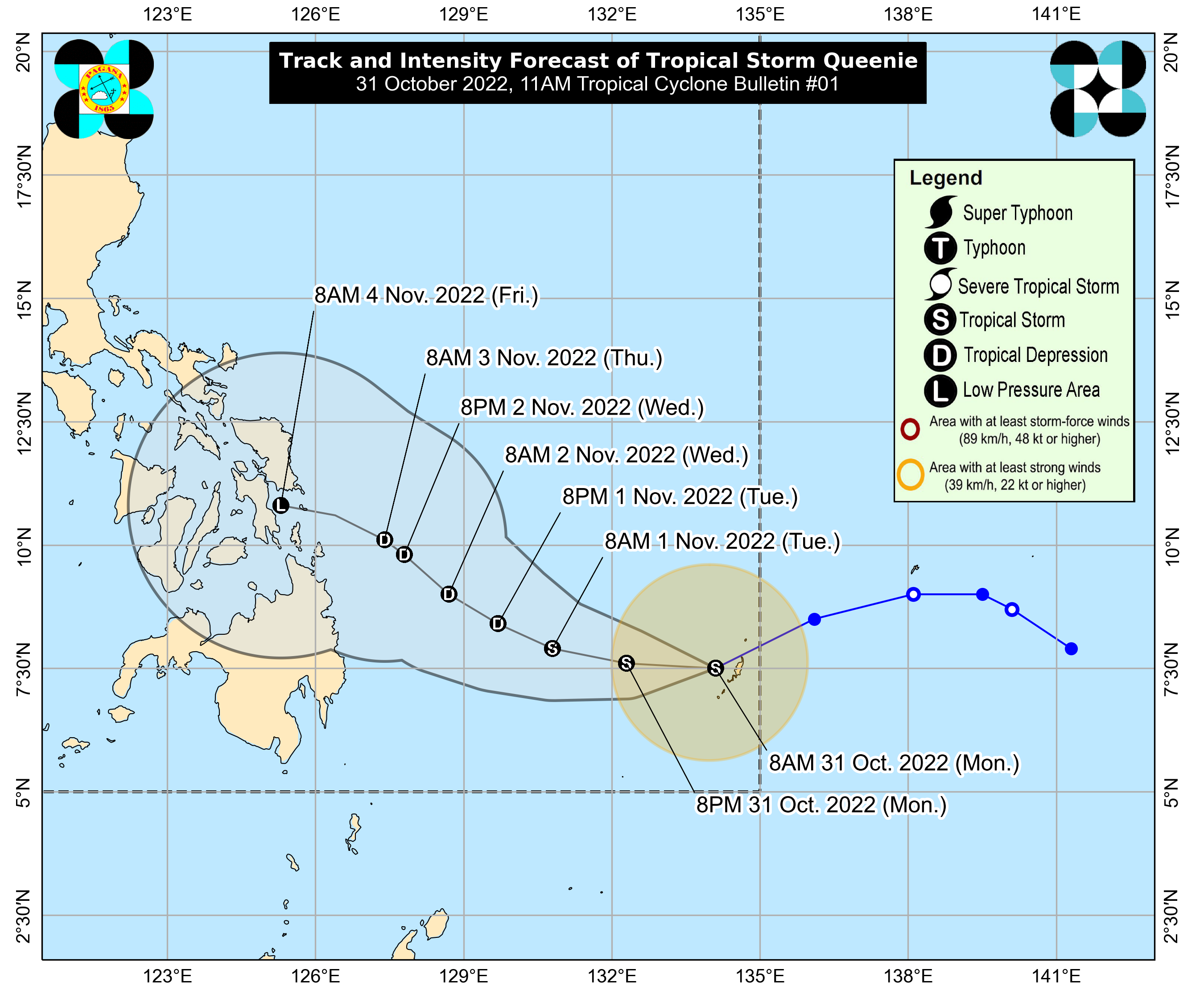

MANILA, Philippines – Tropical Depression Queenie strengthened into a tropical storm on Monday morning, the state weather bureau said in its 11 a.m. weather update.
The Philippine Atmospheric, Geophysical and Astronomical Services Administration (Pagasa) said Queenie was last plotted 815 kilometers east of Northeastern Mindanao with maximum sustained winds of 65 kilometers per hour near the center and gustiness of up to 80 kph.
It is moving west-southwestward at 10 kph.
“Queenie is unlikely to directly affect the country until Tuesday. However, light to moderate with at times heavy rains possible over Caraga, Eastern Visayas, and Bicol Region beginning Wednesday,” Pagasa said.
The storm is seen to intensify further as it tracks westward in the next 12 hours before generally turning west-northwestward on Tuesday through Wednesday morning.
“By Wednesday afternoon, this storm will begin to move generally northwestward towards Caraga, Eastern Visayas area,” the agency detailed.
Pagasa further noted that Queenie might be on a weakening trend by Tuesday evening or Wednesday, possibly de-escalating into a “remnant low” on Friday as it nears Caraga or Eastern Visayas.
Queenie entered the Philippine area of responsibility (PAR) on Monday morning, while severe tropical storm Paeng (international name: Nalgae) continues to traverse over the West Philippine Sea.
Although seen to exit the PAR on Monday afternoon or evening, Paeng is still triggering rains in fourteen areas in the country that remain under Tropical Cyclone Wind Signal No. 1.
RELATED STORY