


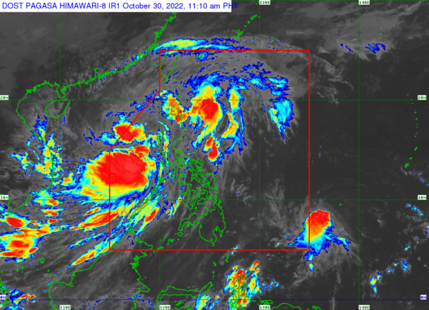
MANILA, Philippines — Tropical Storm Paeng (international name: Nalgae) continues to move west- northwest over the West Philippine Sea after ravaging the country over the weekend, the Philippine Atmospheric, Geophysical and Astronomical Services Administration (Pagasa) said Sunday morning.
In its latest update, Pagasa reported that Paeng was last located 225 kilometers west – northwest of Iba, Zambales, carrying maximum sustained winds of 85 kilometers per hour (kph) near the center and gustiness of up to 105 kph.
“While over the West Philippine Sea, Paeng is forecast to re-intensify into a severe tropical storm within 24 hours and may reach typhoon category by tomorrow evening or on Tuesday morning,” said Pagasa.
It is expected to continue moving west-northwest and may exit the Philippine area of responsibility by Monday morning or afternoon.
Despite swirling away from the country’s landmass, moderate to heavy rains remain possible in Zambales, Bataan, Aurora, Pangasinan, Batanes, and the northern portion of Cagayan, including Babuyan Islands.
Meanwhile, light to moderate and at times heavy rains are forecast in Metro Manila, Cordillera Administrative Region, Calabarzon, Mimaropa, Camarines Norte, Camarines Sur, Western Visayas, and the rest of Cagayan Valley and Central Luzon.
Tropical Cyclone Wind Signal (TCWS) No. 2 (gale-force winds prevailing or expected within the next 24 hours) is still up over the following areas or provinces:
- Luzon
- La Union
- the central and western portions of Pangasinan (San Fabian, San Jacinto, Mapandan, Santa Barbara, Malasiqui, Bautista, Alcala, Urbiztondo, Mangatarem, Basista, San Carlos City, Calasiao, Mangaldan, Dagupan City, Binmaley, Aguilar, Bugallon, Lingayen, Labrador, Infanta, Dasol, Mabini, Sual, City of Alaminos, Burgos, Agno, Bani, Bolinao, Anda, Bayambang)
- the northwestern portion of Tarlac (Camiling, San Clemente, Santa Ignacia, Mayantoc, San Jose, Moncada)
- and the northern portion of Zambales (Santa Cruz, Candelaria, Masinloc, Palauig, Iba)
TCWS No. 1 (strong winds prevailing or expected within the next 36 hours), on the other hand, is still raised over the following areas / provinces:
- Luzon
- Cagayan including Babuyan Islands
- Isabela
- Nueva Vizcaya
- Quirino
- Apayao
- Ifugao
- Mountain Province
- Kalinga
- Abra
- Benguet
- Aurora
- Bulacan
- Nueva Ecija
- Pampanga
- the rest of Tarlac
- the rest of Zambales
- Bataan
- Ilocos Norte
- Ilocos Sur
- the rest of Pangasinan
- Metro Manila
- Batangas
- Cavite
- Laguna
- Rizal
- the northern and central portions of Quezon (Lucena City, Pagbilao, Infanta, Tiaong, Unisan, Plaridel, San Antonio, Alabat, Candelaria, Lucban, Sampaloc, Padre Burgos, Sariaya, City of Tayabas, Mauban, Dolores, General Nakar, Perez, Agdangan, Atimonan, Real) including Pollilo Islands
- the northern and central portions of Occidental Mindoro (Abra de Ilog, Mamburao, Santa Cruz, Paluan, Sablayan) including Lubang Islands
- and the northern and central portions of Oriental Mindoro (Naujan, Puerto Galera, Victoria, San Teodoro, Baco, City of Calapan, Pola, Socorro, Pinamalayan, Gloria, Bansud)
RELATED STORY:
Pagasa: Paeng now over West PH Sea; wet, windy Sunday expected