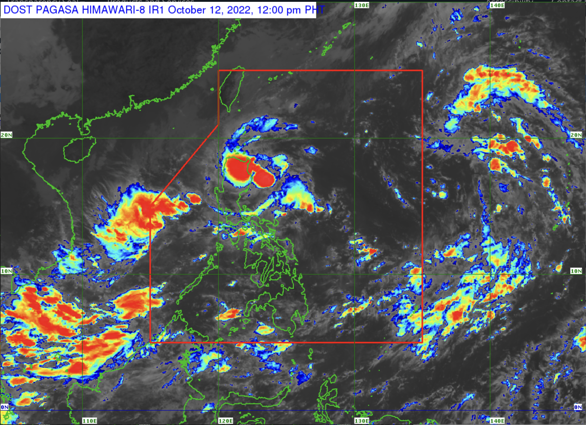
MANILA, Philippines —Tropical Depression Maymay may weaken into a low-pressure area (LPA) before making landfall, but another tropical depression may enter the Philippine area of responsibility (PAR) on Thursday, state meteorologists said.
Maymay is almost stationary at 310 kilometers east northeast of Baler, Aurora, with maximum sustained winds of 45 kilometers per hour and gustiness of up to 55 kilometers per hour, said the Philippine Atmospheric, Geophysical and Astronomical Services Administration (Pagasa).
However, heavy rain is still expected over Cagayan, the northern portion of Isabela, Kalinga, Mountain Province, and Batanes even if Maymay weakens into an LPA.
Signal no. 1 remains hoisted over the following areas:
- Isabela
- Quirino
- Nueva Vizcaya
- Aurora
- Nueva Ecija
- Extreme northern portion of Quezon, including the Polillo Islands
READ: Tropical Depression Maymay triggers rain over parts of Luzon; Signal No. 1 still up in some areas
Meanwhile, the tropical depression spotted outside PAR is currently located 1980 kilometers east of northern Luzon, with maximum sustained winds of 45 kilometers per hour and gustiness of 55 kilometers per hour. Pagasa said the tropical depression may turn into a tropical storm.
The tropical depression may enter PAR by Thursday morning or afternoon and will be given the local name “Neneng” said Pagasa’s weather specialist Raymond Orinario,
According to Ordinario, Pagasa is also monitoring an LPA inside the PAR which is currently located 495 kilometers west of San Jose, Occidental Mindoro.
Ordinario added that neither the LPA nor the tropical depression outside of PAR will be affecting the country on Wednesday.
