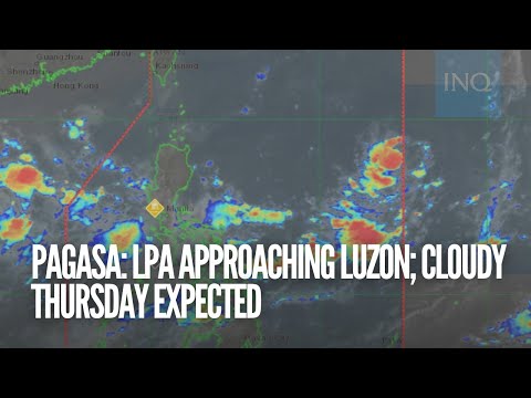
MANILA, Philippines — A low pressure area (LPA) east of Luzon may develop into a tropical depression this coming weekend, according to the Philippine Atmospheric, Geophysical and Astronomical Services Administration (Pagasa).
Meantime, Metro Manila and the rest of the country can expect partly cloudy to cloudy skies with isolated rain showers, due to the southwest monsoon and localized thunderstorms on Thursday.
Areas affected by rainfall may experience flash floods or landslides, Pagasa warned.
In its early morning update, Pagasa said that the LPA was spotted some 1,265 kilometers east of Central Luzon, and will not have a direct impact on the country in the next 24 hours.
“Simula po bukas hanggang sa weekend, ay unti-unting lalapit na ito sa Luzon and as early as Saturday ay posible nang magpa-ulan ito dito sa silangang parte. Particularly Calabarzon, Bicol region at dito rin, sa malaking bahagi ng Visayas. Over the weekend po ay hindi natin inaalis ang tsansa na ang low pressure area ay maging isang bagyo or tropical depression,” said Pagasa weather specialist Benison Estreja in the bureau’s public weather forecast.
(By tomorrow until the weekend, it will slowly approach Luzon. As early as Saturday, rain is possible inn the eastern part of the country, particularly inn the Calabarzon and Bicol regions, as well as a large part of thenVisayas).
Pagasa is also monitoring a tropical depression located some 1,775 kilometers east-northeast of extreme Northern Luzon, outside the Philippine area of responsibility.
*Forecast temperature range in key areas / cities on Thursday:
- Metro Manila — 25 to 33 degrees Celsius
- Baguio — 16 to 23 degrees Celsius
- Laoag — 23 to 32 degrees Celsius
- Tuguegarao — 24 to 34 degrees Celsius
- Legazpi — 24 to 32 degrees Celsius
- Puerto Princesa — 25 to 33 degrees Celsius
- Tagaytay — 22 to 30 degrees Celsius
- Kalayaan Islands — 26 to 33 degrees Celsius
- Iloilo — 24 to 33 degrees Celsius
- Cebu — 26 to 34 degrees Celsius
- Tacloban — 26 to 33 degrees Celsius
- Cagayan de Oro — 24 to 31 degrees Celsius
- Zamboanga — 25 to 34 degrees Celsius
- Davao — 24 to 33 degrees Celsius