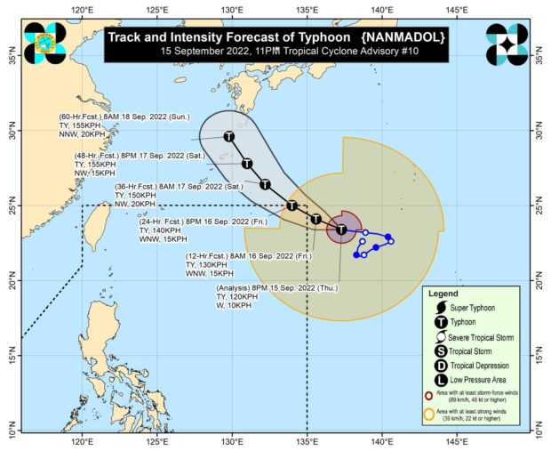
MANILA, Philippines — Typhoon Nanmadol may enter the Philippine area of responsibility on Friday but it could exit the country on Friday evening or Saturday morning, the Philippine Atmospheric Geophysical and Astronomical Services Administration (Pagasa) said in its latest advisory.
In its 11 pm advisory, Pagasa said the center of the Nanmadol was estimated at 1,600 km east northeast of extreme northern Luzon, packing maximum sustained winds of 120 kilometers per hour (kph) with gustiness of up to 150 kph.
Once it enters, the typhoon will be called “Josie.”
Nanmadol reached the typhoon category at around 2:00 pm.
Pagasa also said that “Nanmadol” is far from the country’s land mass but it will enhance the southwest monsoon or habagat which will bring rain in several parts of the country.
“However, the southwest monsoon enhanced by Nanmadol will bring monsoon rains over the western sections of Southern Luzon, Visayas, and Mindanao,” the state meteorologist said.
Nanmadol-enhanced habagat “may also bring gusty conditions reaching strong breeze to near-gale strength” especially in coastal and mountainous or upland areas of Visayas, Mimaropa, Bicol Region, and the northern and western portions of Mindanao.
