


New tropical depression may enter PAR on Tuesday as Inday heads out
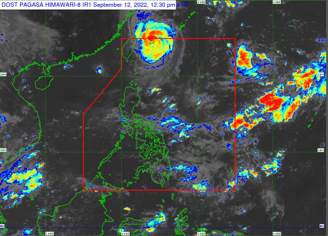
Pagasa weather satellite image.
MANILA, Philippines – While Typhoon Inday (International Name: Muifa) is gradually moving out of the country, another tropical depression has been monitored and is expected to enter the Philippine area of responsibility (PAR) on Tuesday, said the state weather bureau.
In its 11 a.m. weather update, the Philippine Atmospheric, Geophysical and Astronomical Services Administration (Pagasa) said the low-pressure area outside the PAR has now developed into a tropical depression, which was last sighted 1,815 kilometers east of extreme northern Luzon.
“Itong tropical depression na ito ay posibleng pumasok ng PAR bukas pero patuloy pa rin natin itong babantayan kasi ang pagkilos nito ay pakanluran hilagang kanluran so posible po na pumasok, posible rin na hindi pumasok sa loob ng PAR itong tropical depression na ito,” state weather service specialist Obet Badrina said.
(This tropical depression may enter the PAR on Tuesday. However, we’ll continue monitoring its movement since it’s currently heading west-northwestward, which means it may or may not enter the PAR.)
The tropical depression will be assigned the domestic name Josie once it enters the PAR.
Like Inday, Badrina said Josie is not seen to impact the country directly.
READ: Pagasa: Fair Monday weather as Typhoon Inday heads for Japan
Inday, on the other hand, is now 465 kilometers north northeast of Itbayat, Batanes, packing maximum sustained winds of 150 kilometers per hour (kph) near the center and gustiness of up to 185 kph, according to Pagasa.
Although it will not spawn heavy rains, Badrina noted that strong winds will still be experienced in the extreme Northern Luzon “due to the channeling of the typhoon circulation in the Luzon Strait.”
A gale warning remains raised over Batanes and Babuyan Islands, where 1.2 to 4 meter-high waves are possible.


