Track of Typhoon Inday. Image from Pagasa
MANILA, Philippines – Tropical Storm Inday (International name: Muifa) may progress into a severe tropical storm by Friday morning, the state weather bureau said.
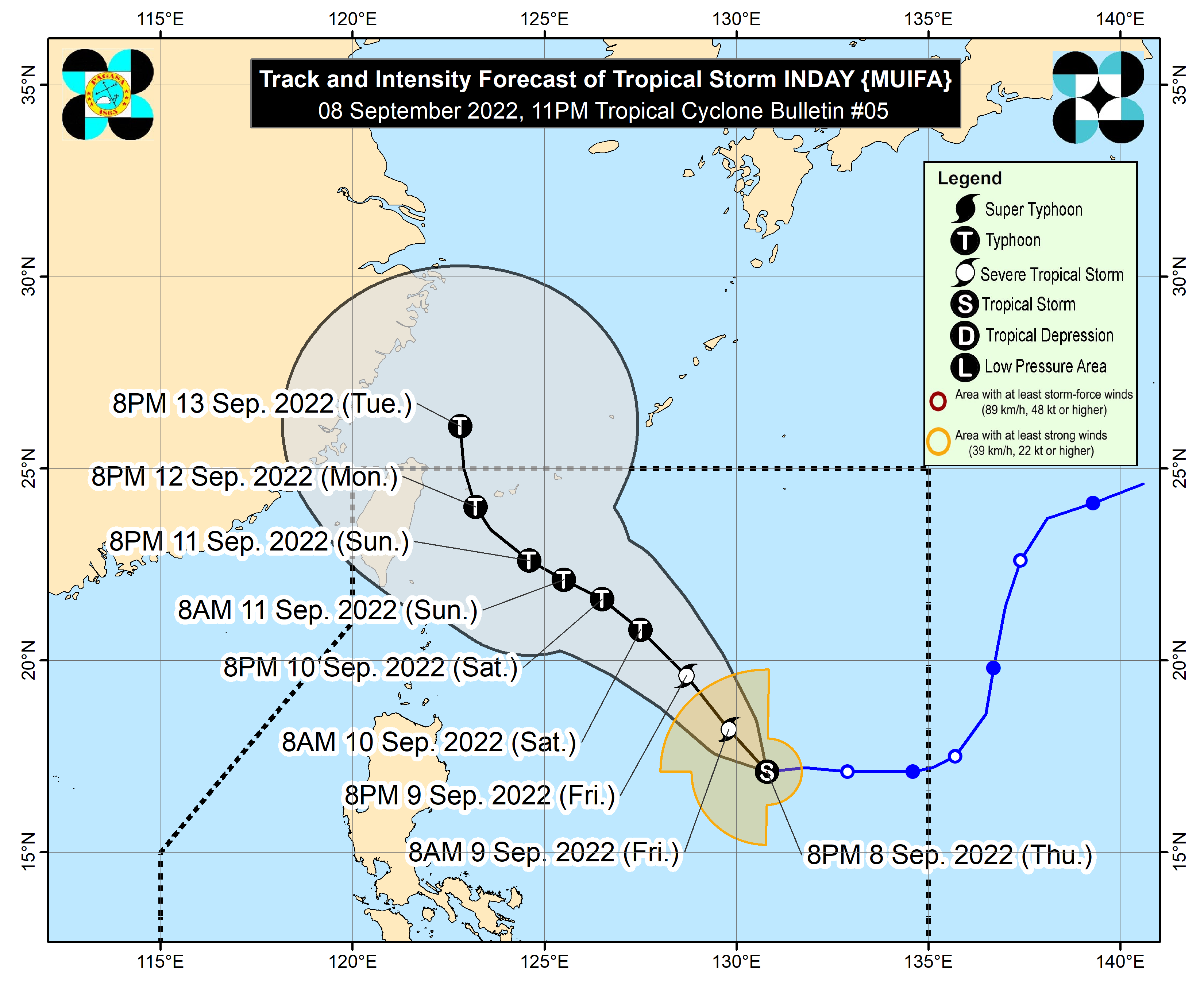
In a briefing late Thursday evening, the Philippine Atmospheric, Geophysical and Astronomical Services Administration (Pagasa) said Inday was last sighted 885 kilometers east of Northern Luzon, packing maximum sustained winds of 75 kilometers per hour (kph) near the center and gustiness of up to 90 kph.
It is moving westward at 10 kph, Pagasa added.
“Posible as early as tomorrow morning, araw po ng Biyernes, ay lumakas na ito bilang isang severe tropical storm then, pagsapit ng weekend, posibleng maging typhoon na ito o mas malakas pa na bagyo,” state weather service specialist Benison Estareja said.
(It’s possible that as early as Friday morning, Inday will further strengthen into a severe tropical storm and then by the weekend, it may become a typhoon.)
He then noted that once Inday passes through Ryukyu Islands in Japan, it is expected to exit the Philippine area of responsibility (PAR) by Monday or Tuesday.
According to Estareja, Inday’s trough or extension is indirectly affecting the southern parts of Luzon and Visayas, including the Bicol Region (Albay, Camarines Norte, Camarines Sur, Catanduanes, Masbate, Sorsogon), Samar provinces, Calabarzon (Batangas, Cavite, Laguna, Quezon, Rizal), and Mimaropa (Marinduque, Occidental Mindoro, Oriental Mindoro, Palawan, Rizal).
Meanwhile, localized thunderstorms are experienced in Western Visayas, Zamboanga Peninsula, Basilan, Sulu, and Tawi-Tawi due to a slightly intensified southwest monsoon.
Inday, which entered the PAR on Wednesday, is not seen to make landfall in the country.