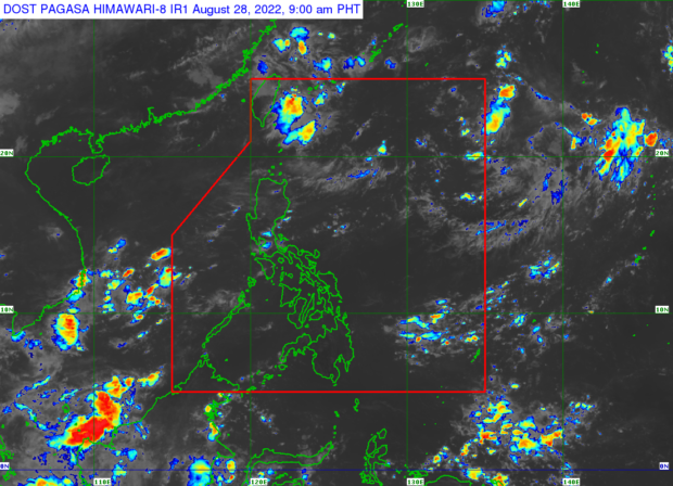
MANILA, Philippines — A low pressure area (LPA) is expected to form east of extreme Northern Luzon and enter the Philippine area of responsibility (PAR) before the end of the month, according to the Philippine Atmospheric, Geophysical and Astronomical Services Administration (Pagasa).
“Sa susunod na tatlong araw posibleng may mabuo na low pressure area sa cloud custers at bago matapos ang Agosto, posibleng nasa loob na ito ng PAR,” said Pagasa weather specialist Benison Estareja.
(In the next three days, a low pressure area may form in the cloud custers and may enter PAR befpre the end of the month.)
“Kung saka sakaling mabuo ang LPA, hindi rin natin inaalis ang possibility na maging bagyo ito o tropical cyclone,” he added.
(In the event that the LPA forms, we also do not rule out the possibility that it will become a typhoon or tropical cyclone.)
He assured the public, however, that the said weather disturbance has a low chance of hitting the country’s landmass.
Meanwhile, fair weather conditions are expected on Sunday, with possible thunderstorms and isolated rain showers in the afternoon and evening.
* Forecast temperature range in key cities on Sunday:
- Metro Manila: 25 to 32 degrees Celsius
- Baguio City: 17 to 23 degrees Celsius
- Laoag City: 24 to 32 degrees Celsius
- Tuguegarao: 25 to 34 degrees Celsius
- Legazpi City: 25 to 32 degrees Celsius
- Puerto Princesa City: 25 to 32 degrees Celsius
- Tagaytay: 22 to 29 degrees Celsius
- Kalayaan Islands: 26 to 32 degrees Celsius
- Iloilo City: 25 to 32 degrees Celsius
- Cebu: 25 to 32 degrees Celsius
- Tacloban City: 26 to 32 degrees Celsius
- Cagayan De Oro City: 24 to 31 degrees Celsius
- Zamboanga City: 24 to 33 degrees Celsius
- Davao City: 25 to 32 degrees Celsius
