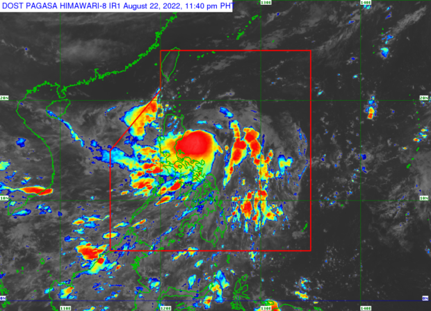

MANILA, Philippines — Tropical Storm Florita slightly intensified on Monday night as it continued to coast westward through the Philippine Sea, according to the Philippine Atmospheric Geophysical and Astronomical Services Administration (Pagasa).
According to Pagasa’s latest tropical cyclone bulletin, Florita was last located 125 km east of Casiguran, Aurora with maximum sustained winds of 85 kph and gustiness of up to 105 kph.
Florita is expected to make landfall on the east coast of Isabela or Cagayan on Tuesday morning and may intensify into a severe tropical storm before doing so.
Heavy to intense with at times torrential rains are forecast over Cagayan, Isabela, Cordillera Administrative Region, Ilocos Region, and Zambales, while moderate to heavy with at times intense rains over Camarines Norte, Camarines Sur, Aurora, Quezon, Bataan, and the rest of Cagayan Valley.
Meanwhile, light to moderate with at times heavy rains are expected over Metro Manila, Calabarzon, and the rest of Central Luzon.
The list of areas placed under Signal No. 2 (gale-force winds prevailing or expected within the next 24 hours) are the following:
- Cagayan
- the southern portion of Babuyan Islands (Camiguin, Fuga, Dalupiri, Pamuktan, Barit, Mabag, Irao islands)
- Isabela
- Quirino
- the eastern and central portions of Nueva Vizcaya (Kayapa, Ambaguio, Solano, Villaverde, Bagabag, Diadi, Quezon, Bayombong, Bambang, Aritao, Dupax del Sur, Dupax del Norte, Kasibu, Alfonso Castaneda)
- Apayao
- Abra
- Kalinga
- Mountain Province
- Ifugao
- the northern portion of Benguet (Bakun, Kibungan, Buguias, Kabayan, Mankayan, Bokod, Atok)
- Ilocos Norte
- Ilocos Sur
- the northern and central portions of Aurora (Dilasag, Casiguran, Dinalungan, Dipaculao, Baler, Maria Aurora)
Meanwhile, the following areas are currently under Signal No. 1 (strong winds prevailing or expected within the next 36 hours):
- the rest of the Babuyan Islands
- the rest of Nueva Vizcaya
- the rest of Benguet
- La Union
- the eastern and central portions of Pangasinan (Bani, Bolinao, City of Alaminos, Anda, Sual, Labrador, Bugallon, Aguilar, Mangatarem, Urbiztondo, Bayambang, Bautista, Alcala, Santo Tomas, Rosales, Balungao, Umingan, San Quintin, Natividad, San Nicolas, Tayug, Santa Maria, Asingan, San Manuel, Sison, Binalonan, City of Urdaneta, Villasis, Laoac, Pozorrubio, San Fabian, San Jacinto, Manaoag, Mapandan, Mangaldan, Santa Barbara, Malasiqui, Dagupan City, Calasiao, San Carlos City, Basista, Binmaley, Lingayen)
- the eastern portion of Tarlac (San Clemente, Camiling, Moncada, San Manuel, Anao, Santa Ignacia, Gerona, Paniqui, Ramos, Pura, Victoria, La Paz, City of Tarlac, Concepcion)
- Nueva Ecija
- the rest of Aurora
- the eastern portion of Pampanga (Magalang, Arayat, Candaba)
- the eastern portion of Bulacan (San Ildefonso, San Miguel, Doña Remedios Trinidad, San Rafael, Angat, Norzagaray, City of San Jose del Monte)
- the eastern portion of Rizal (Rodriguez, San Mateo, City of Antipolo, Tanay, Baras)
- the northern portion of Quezon (General Nakar, Infanta, Real, Mauban, Perez, Alabat, Quezon, Calauag) including Polillo Islands
- the northern portion of Laguna (Santa Maria, Famy, Siniloan, Pangil, Pakil, Paete),
- Camarines Norte