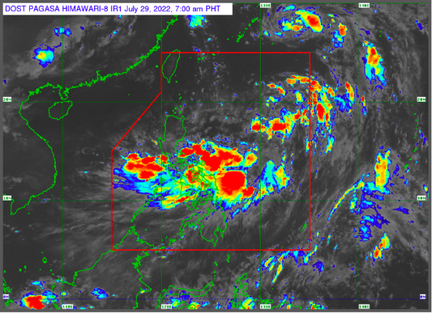
LPA off northern Luzon likely to develop into a tropical depression — Pagasa
MANILA, Philippines — The low pressure area spotted off northern Luzon is highly likely to develop into a tropical depression and, combined with the effects of the southwest monsoon, or habagat, will bring rain showers and thunderstorms in many parts of the country, including Metro Manila.
In its 5 am weather advisory, the Philippine Atmospheric Geophysical and Astronomical Services Administration (Pagasa) said that once the LPA, which was last located 1,020 kilometers east of extreme northern Luzon, develops into a tropical depression, it would be called “Ester.”
“The development of this weather disturbance into a tropical depression is highly possible within the next 24 hours,” said Pagasa weather specialist Benison Estareja.
Pagasa also said the “combined effects of the LPA and the southwest monsoon will bring scattered light to moderate with at times heavy rain showers and thunderstorms” to the areas of Metro Manila, Calabarzon, Mimaropa, Bicol Region, Samar provinces, Zambales, Bataan, Aklan, and Antique.
“Under these conditions, scattered flooding and rain-induced landslides are likely, especially in the areas that are very highly susceptible to these hazards,” Pagasa also said.
The rest of the country, meanwhile, will experience fair weather conditions with partly cloudy to cloudy skies with isolated rain showers and thunderstorms due to habagat.
Despite the presence of an LPA, Pagasa has not raised a gale warning to any seaboards nationwide.
RELATED STORY:
LPA-enhanced southwest monsoon to bring rain over several parts of PH
Rainy Friday in parts of southern Luzon due to LPA, habagat — Pagasa
