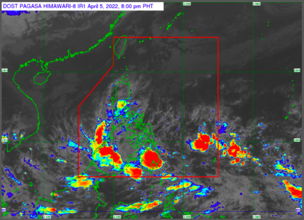
Weather satellite image from Pagasa
MANILA, Philippines — Going somewhere on Wednesday? Better bring an umbrella with you.
The state weather service said cloudy skies and rainy weather would continue through April 6 over most parts of the country due to the combination of shear line, or tail end of a cold front, and the low-pressure area (LPA) approaching Mindanao.
Based on the weather bulletin of the Philippine Atmospheric Geophysical and Astronomical Services Administration (Pagasa) on Tuesday, majority of Luzon including Metro Manila, Central Luzon, Calabarzon, Mimaropa, and Bicol Region, as well as the entire Visayas and Mindanao regions will experience overcast skies with scattered to widespread rain showers and thunderstorms due to the shear line and LPA.
As for the rest of Luzon, Pagasa said there will be partly cloudy to cloudy skies and only isolated light rains as the “northeasterly surface wind flow” remains the dominant weather system in the area.
Pagasa weather specialist Ana Clauren said the LPA was at 260 kilometers east-northeast of Davao City around 3 p.m. Tuesday. Although it is causing rain in many areas across the country, the state weather service said it has a slim chance of developing into a typhoon.
Gale warnings, meanwhile, were raised over a number of the country’s seaboards due to the northeasterly surface wind flow.
Pagasa said the seaboards of Batanes, Cagayan including Babuyan Islands, the northern coast of Ilocos Norte, Isabela, Aurora, Ilocos Sur, and western coast of Ilocos Norte could expect rough to very rough sea conditions with 2.8 to 5.0 meters of waves.
The coasts of Northern Quezon, Camarines Sur, and the northern and eastern coasts of Catanduanes will also experience rough to very rough sea conditions with 2.8 to 4.5 meters of waves, according to Pagasa.
RELATED STORY
Northeasterly winds, shear line, LPA combine to bring rains over PH