LPA may enter PAR on Saturday, bringing cloudy skies, rains to Caraga, Eastern Visayas

PAGASA
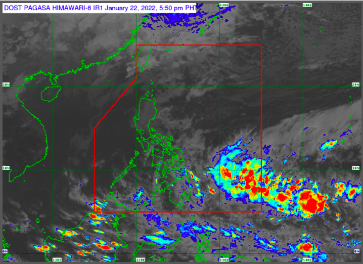
MANILA, Philippines — The low pressure area detected east of Mindanao will bring cloudy skies with scattered rain showers and thunderstorms to Caraga and Eastern Visayas on Sunday, the state weather bureau reported on Saturday.
The LPA is detected 1,130 kilometers east of Mindanao as of 2 p.m., according to Raymond Ordinario, weather specialist of Philippine Atmospheric Geophysical and Astronomical Services Administration (Pagasa).
Ordinario said the LPA may enter the Philippine Area of Responsibility on Saturday night or Sunday morning.
“Hindi natin nakikitaan ng potential na maging bagyo ang nasabing low pressure area,” Ordinario said in a public weather forecast.
(We don’t see any potential that this low pressure area will become a typhoon.)
Article continues after this advertisementThe trough of LPA, however, will bring cloudy skies with scattered rain showers and thunderstorms to Caraga and Eastern Visayas.
Article continues after this advertisementThe northeast monsoon, locally known as amihan, will also bring cloudy skies with rains in Cagayan Valley, Cordillera Administrative Region, Aurora and Quezon.
Fair weather is expected in Metro Manila and the rest of the country which will only experience partly cloudy to cloudy skies with isolated light rains to rain showers and thunderstorms.
However, Pagasa raised gale warning is raised in the seaboards of Batanes, Babuyan Islands, Cagayan, Northern coast of Ilocos Norte and Northern Aurora, which will experience moderate to strong sea condition with 2.8 to 4.0 meters of waves.