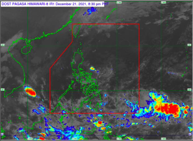

MANILA, Philippines — The low-pressure area (LPA) detected off Mindanao may enter the Philippine Area of Responsibility (PAR) by Wednesday, the state weather bureau reported on Tuesday.
“Ang low-pressure area ay inaasahan na maaaring pumasok sa PAR bukas o sa Huwebes,” said Philippine Atmospheric Geophysical Astronomical Services Administration (Pagasa weather specialist Nikos Peñaranda in a public weather forecast.
(The low pressure area is expected to enter PAR tomorrow or by Thursday.)
Peñaranda said the LPA will bring rains to Eastern Visayas and Northeastern Mindanao.
The LPA has a low chance of becoming a tropical depression, he added.
While the LPA may enter the PAR on Wednesday, it is the shearline or the tail end of a cold front and the Intertropical Convergence Zone (ITCS) that would bring rain to parts of northern Luzon and Mindanao, respectively.
The shear line will bring cloudy skies with scattered rain showers and thunderstorms to Batanes, Cagayan, Isabela, and Aurora, while the ITCZ will also cause a similar weather condition in the entire Mindanao.
The rest of the country is expected to have partly cloudy to cloudy skies with isolated rain showers.
RELATED STORY
Pagasa says LPA off Mindanao has ’30-40%’ chance of becoming tropical depression