
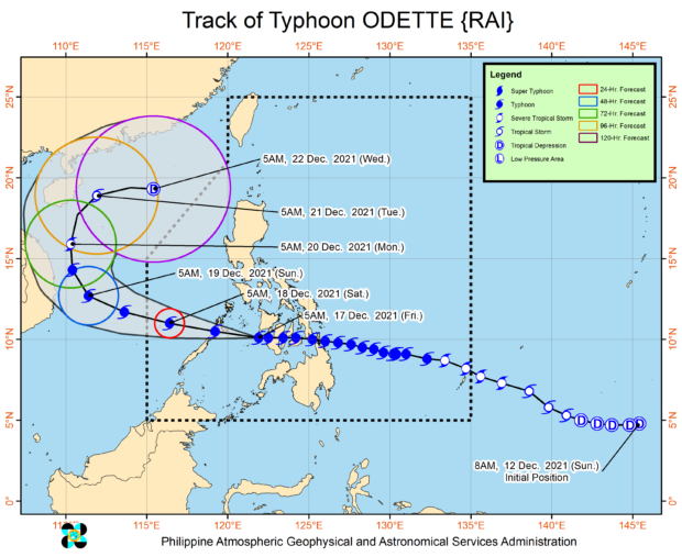
Forecast track of typhoon Odette as of 8 a.m., December 17, 2021 (Image from Pagasa)
MANILA, Philippines — Typhoon Odette (international name: Rai) was crossing the Sulu Sea between Cuyo and Cagayancillo Islands on Friday morning and is expected to make another landfall in the vicinity of Palawan’s northern or central portion by afternoon.
This was the latest bulletin from the Philippine Atmospheric Geophysical and Astronomical Services Administration (Pagasa), which also said that at 7 a.m., Odette’s eye was seen 155 kilometers (km) west-southwest of Iloilo City or 90 km south southeast of Cuyo, Palawan.
It added that Odette was moving westward at 15 kilometers per hour (kph), as it packed maximum sustained winds of 155 kph near the center and gustiness of up to 235 kph.
“Moving generally westward, the typhoon is forecast to make landfall in the vicinity of the northern or central portion of Palawan this morning or afternoon, re-emerge over the West Philippine Sea tonight, and pass in the vicinity of Kalayaan Islands tomorrow. The typhoon is forecast to exit the Philippine Area of Responsibility tomorrow morning or early afternoon,” Pagasa said in its 8 a.m. advisory Friday.
“Odette may still see some slight weakening until it crosses Palawan, but it is forecast to remain as a typhoon. Re-intensification is likely once Odette emerges over the West Philippine Sea. However, continuous weakening may ensue beginning Sunday as the typhoon becomes exposed to increasing vertical wind shear and the surge of the Northeast Monsoon,” the state weather bureau added.
Tropical Cyclone Wind Signal (TCWS) No. 3 remains raised over these areas:
Luzon
- northern portion of Palawan (El Nido, Taytay, Araceli, Dumaran, Roxas, San Vicente, Puerto Princesa City) including Cagayancillo and Cuyo Islands
Visayas
- Guimaras
- southern portion of Iloilo (Tigbauan, Leon, Tubungan, Guimbal, Igbaras, Miagao, San Joaquin)
- southern portion of Antique (Patnongon, San Remigio, San Jose, Belison, Sibalom, Hamtic, Tobias Fornier, Anini-Y)
Pagasa said these areas could expect destructive typhoon-force winds within 18 hours.
On the other hand, areas below were placed under TCWS No. 2, where damaging gale to storm-force winds is prevailing or expected within 24 hours:
Luzon
- southern portion of Oriental Mindoro (Bansud, Bulalacao, Roxas,
Bongabong, Mansalay) - southern portion of Occidental Mindoro (Rizal, San Jose, Magsaysay, Calintaan, Sablayan)
- western portion of Romblon (Looc, Ferrol, Santa Fe, San Jose, Alcantara, Santa Maria, Odiongan, San Agustin, San Andres, Calatrava)
- central portion of Palawan (Narra, Sofronio Española, Quezon, Aborlan, Rizal, Brooke’s Point) including Kalayaan and Calamian Islands
Visayas
- Aklan
- Capiz
- rest of Iloilo
- rest of Antique
- Guimaras
- Negros Oriental
- Negros Occidental
- southern portion of Cebu (Toledo City, Pinamungahan, San Fernando, City of Carcar, Aloguinsan, Barili, Sibonga, Dumanjug, Argao, Ronda, Alcantara, Moalboal, Badian, Dalaguete, Alegria, Alcoy, Malabuyoc, Boljoon, Oslob, Ginatilan, Samboan, Santander)
TCWS No. 1, meanwhile, were hoisted over the following areas, where strong winds are prevailing or are expected within 36 hours:
Luzon
- western portion of Camarines Sur
- Albay (Del Gallego, Ragay, Lupi, Sipocot, Libmanan, Cabusao, Calabanga, Bombon, Magarao, Canaman, Pamplona, Camaligan, Gainza, Pasacao, Naga City, Milaor, San Fernando, Pili, Ocampo, Sagñay, Buhi, Iriga City, Baao, Bula, Minalabac, Nabua, Balatan, Bato)
- Sorsogon
- Masbate including Ticao and Burias Islands
- Marinduque
- southern portion of Quezon (San Antonio, Tiaong, Candelaria, Sariaya, Dolores, Lucena City, Pagbilao, Padre Burgos, Atimonan, Agdangan, Unisan, Gumaca, Plaridel, Pitogo, Lopez, Guinayangan, Buenavista, Catanauan, General Luna, Macalelon, Mulanay, San Narciso, San Andres, San Francisco, Tagkawayan, Calauag, Quezon, Alabat, City of Tayabas, Perez)
- rest of Occidental Mindoro including Lubang Islands
- rest of Oriental Mindoro
- rest of Palawan
- rest of Romblon
- Batangas
Visayas
- western portion of Northern Samar (Lope de Vega, Catarman, Bobon, San Jose, Rosario, Lavezares, Biri, Allen, Victoria, San Isidro, San Antonio, Capul, San Vicente)
- western portion of Samar (Calbayog City, Santa Margarita, Gandara, Pagsanghan, Tarangnan, San Jorge, City of Catbalogan, Zumarraga, Daram, Talalora, Villareal, Santa Rita, Santo Niño, Almagro, Tagapul-An)
- Bohol
- Biliran
- Leyte
- western portion of Southern Leyte (Sogod, Tomas Oppus, Bontoc, Malitbog, Padre Burgos, Macrohon, City of Maasin, Limasawa)
- rest of Cebu including Bantayan and Camotes Islands
- Siquijor
Mindanao
- northern portion of Zamboanga del Norte (Baliguian, Gutalac, Kalawit, Labason, Liloy, Tampilisan, Salug, Godod, Bacungan, Sindangan, Siayan, Jose Dalman, Manukan, Pres. Manuel A. Roxas, Katipunan, Sergio Osmeña Sr., Dipolog City, Polanco, Piñan, Mutia, Dapitan City, La Libertad, Sibutad, Rizal)
- northern portion of Misamis Occidental (Don Victoriano Chiongbian, Aloran, Oroquieta City, Lopez Jaena, Concepcion, Sapang Dalaga, Calamba, Baliangao, Plaridel)
Heavy rainfall
Pagasa likewise warned that heavy to torrential rains are likely to occur over Western Visayas, Palawan including Calamian, Cuyo, and Cagayancillo Islands, and Negros Oriental on Friday while moderate to heavy with at times intense rains are possible in Bicol Region, Zamboanga Peninsula, Quezon, and the rest of Mimaropa.
Further, it said light to moderate with at times heavy rains will prevail over the Metro Manila, Cagayan Valley, Cordillera Administrative Region, Caraga, Northern Mindanao, Aurora, Lanao del Sur, and the rest of Visayas on Friday.