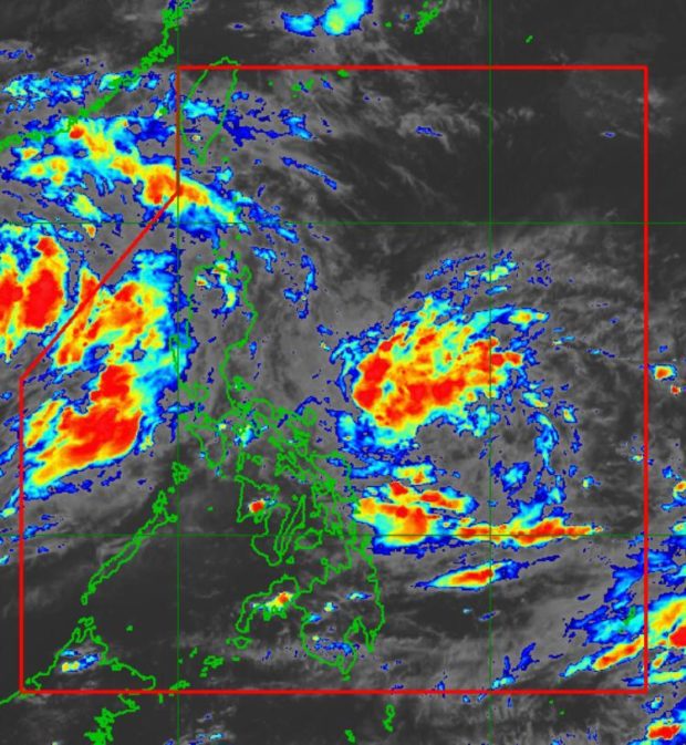
MANILA, Philippines — The low-pressure area (LPA) previously located east of Daet, Camarines Norte developed into a tropical depression on Thursday afternoon.
“At 2:00 p.m. today, the Low-Pressure Area (LPA) east of Daet, Camarines Norte developed into Tropical Depression #MaringPH,” the Philippine Atmospheric, Geophysical and Astronomical Services Administration (Pagasa) said over Twitter.
According to the state weather bureau, tropical cyclone bulletins about Maring would be issued starting 5 p.m. today (Thursday).
At 2:00 PM today, the Low Pressure Area (LPA) east of Daet, Camarines Norte developed into Tropical Depression #MaringPH.
Tropical Cyclone Bulletins will be issued starting 5:00 PM later. pic.twitter.com/cS4CMtVg4s
— PAGASA-DOST (@dost_pagasa) October 7, 2021
Based on the weather bulletin of Pagasa issued at 4 p.m., the center of the tropical depression was now located 505 kilometers east of Virac, Catanduanes. The tropical cyclone packs maximum sustained winds of 45 kilometers per hour (kph) near the center and gustiness of up to 55 kph. It is moving south-southeastward at 15 kph.
Meanwhile, Pagasa also said that the intertropical convergence zone (ITCZ) affects the rest of the country.
Pagasa said Metro Manila, Calabarzon, Central Luzon, Ilocos Region, Bicol Region, Eastern Visayas, Benguet, Abra, Batanes, Babuyan Islands, Mindoro Provinces, and Marinduque will experience cloudy skies with scattered rain showers and thunderstorms due to the ITCZ or the trough of tropical depression Maring.
The rest of the country will have partly cloudy to cloudy skies with isolated rain showers or thunderstorms caused by the ITCZ, said Pagasa.
