


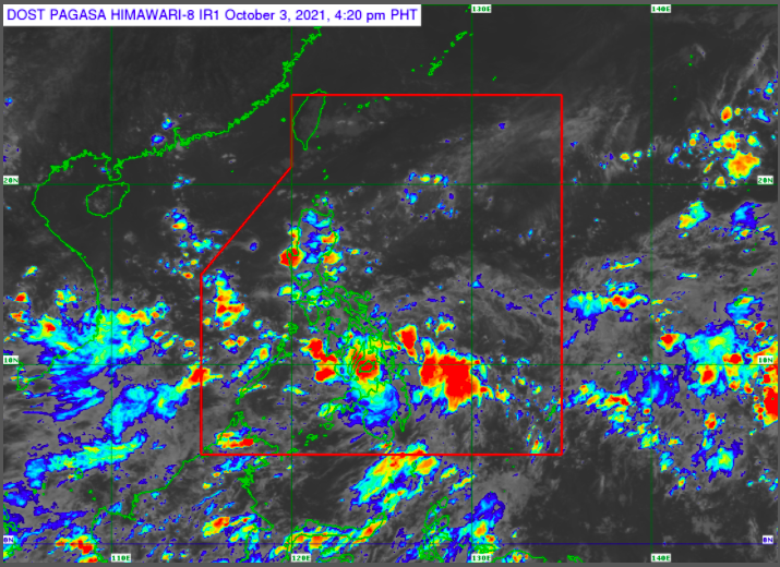
Pagasa weather satellite as of Oct. 3, 4:20 p.m. Screengrab from Pagasa’s website.
MANILA, Philippines — The low pressure area (LPA), embedded along the intertropical convergence zone (ITCZ), will dampen parts of the country, the Philippine Atmospheric, Geophysical, and Astronomical Services Administration (Pagasa) said Sunday.
Based on Pagasa’s 24-hour weather forecast issued at 4 p.m., the LPA will bring cloudy skies with scattered rain showers and thunderstorms over Eastern Visayas, Central Visayas, and Mindanao.
The LPA was spotted at 185 kilometers east of Hinatuan, Surigao del Sur at 3 p.m.
Meanwhile, the rest of the country will experience partly cloudy to cloudy skies with isolated rain showers brought by the ITCZ and localized thunderstorms.
Pagasa warned the public against potential flash floods or landslides during severe thunderstorms.
On the other hand, the country’s coastal waters would be slight to moderate with a wave height of 0.6 to 2.5 meters, Pagasa said.
RELATED STORIES
Expect fair weather in most parts of PH this weekend — Pagasa
Cloudy skies, scattered rains over most parts of PH on Sunday — Pagasa