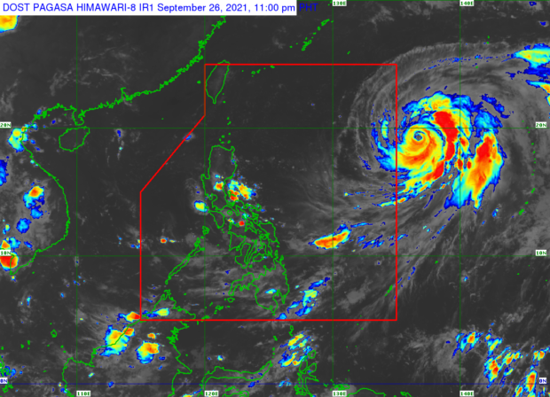
MANILA, Philippines — A typhoon brewing over the Philippine Sea is expected to enter the country’s area of responsibility on Tuesday or Wednesday, the Philippine Atmospheric, Geophysical and Astronomical Services Administration (Pagasa) said.
Typhoon “Mindulle” will be given the local name “Lannie” once inside the Philippine territory, but it is not expected to linger or directly affect the weather in the country this week.
As of 3 p.m. on Sunday, the cyclone was 1,555 kilometers east of extreme Northern Luzon. It further intensified as it traveled over the open waters, blowing winds of up to 205 km per hour and gusts of up to 250 kph.
Pagasa said Mindulle was moving north-northwestward slowly and may reach peak intensity by Monday.
The typhoon may slowly lose strength beginning on Wednesday, as it turns toward the north northeast, and northeast direction, according to weather specialists.
While it is not expected to affect the weather condition in the country, it may cause moderate to rough seas over the northern and eastern seaboards of Luzon beginning on Monday.
Pagasa said sea travel would be risky for small sea craft. Mariners are advised to take precautionary measures. INQ
