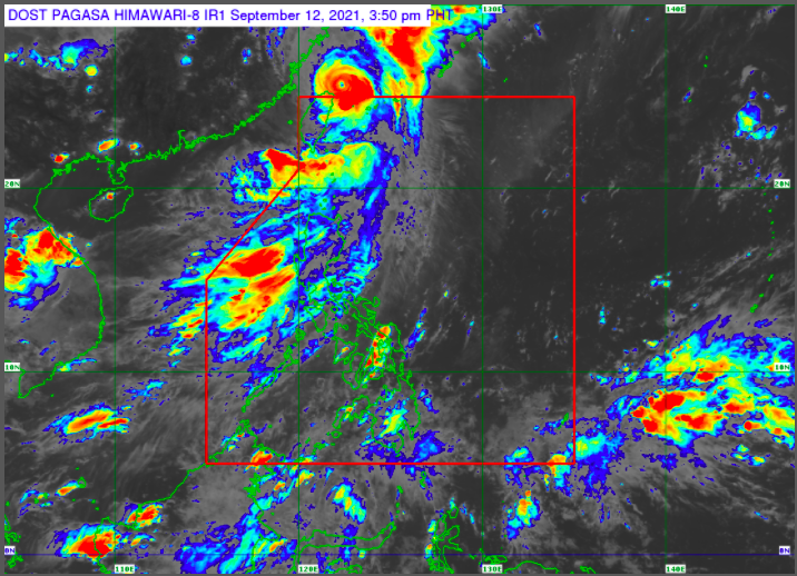
MANILA, Philippines — Typhoon Kiko exited the Philippine Area of Responsibility (PAR) on Sunday afternoon but most parts of the country will experience cloudy skies and isolated rain because of the southwest monsoon or habagat.
A weather forecast by the Philippine Atmospheric, Geophysical, and Astronomical Services Administration (Pagasa) said the habagat will prevail in the country over the next 24 hours.
Pagasa said the habagat will dump rain over the Ilocos Region, the Cordillera Administrative Region, Zambales, Bataan, Batanes, and the Babuyan Islands.
It will also cause cloudy skies with scattered rain showers and thunderstorms over Metro Manila, Calabarzon (Cavite, Laguna, Batangas, Rizal, Quezon), Occidental Mindoro, Palawan, and the rest of Cagayan Valley and Central Luzon.
The rest of the country, meanwhile, will have partly cloudy to cloudy skies with isolated rain showers and thunderstorms brought by the habagat and localized thunderstorms.
Luzon will have moderate to rough seas while the Visayas and Mindanao will experience slight to moderate rough seas.
As of 3 p.m., Kiko was seen at 515 kilometers north of Itbayat, Batanes with maximum sustained winds of 165 kilometers per hour (kph) and gustiness of up to 205 kph.
RELATED STORIES:
Typhoon Kiko slightly weakens; Itbayat still under Signal No. 2
3 confirmed dead, 19 injured due to Typhoon Jolina
