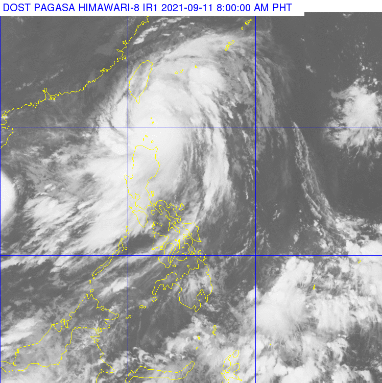
Typhoon Kiko to make landfall in vicinity of Batan, Sabtang Islands
MANILA, Philippines — Typhoon Kiko is forecast to make landfall in the vicinity of Batan and Sabtang Islands in Batanes within the next three hours, the Philippine Atmospheric, Geophysical and Astronomical Services Administration (Pagasa) said Saturday morning.
The center of the eye of the typhoon was last spotted over the coastal waters of Sabtang, Batanes, based on the 8 a.m. bulletin of Pagasa.
Moving north-northwestward at 15 kilometers per hour, the typhoon is packing maximum sustained winds of 215 kph and gusts of 265 kph.
Tropical Cyclone Wind Signals (TCWS) No. 4 is raised over the following areas, where “very destructive typhoon-force winds” are prevailing or expected within 12 hours:
- Batanes
- Northeastern portion of Babuyan Islands
TCWS No. 3 is raised over the northwestern portion of Babuyan Islands (Panuitan Is., Calayan Is.) where “destructive typhoon-force winds” are prevailing or expected within 18 hours.
Meanwhile, TCWS No. 2 is raised over the rest of Babuyan Islands areas where “damaging gale-force to storm-force winds” are prevailing or expected within 24 hours.
TCWS No. 1 is raised over the following areas where strong winds are prevailing or expected within 36 hours:
- Mainland Cagayan
- Apayao
- northern portion of Ilocos Norte (Adams, Dumalneg, Bangui, Vintar, Carasi, Nueva Era, Piddig, Solsona, Burgos, Pasuquin, Bacarra, Laoag City, San Nicolas, Sarrat, Dingras, Pagudpud)
Pagasa said a “moderate to high risk of life-threatening storm surge reaching 2.0 to 3.0 m in height may occur in the next 24 hours.”
“Rising sea water along with the high waves from the shoreline moving inland may cause flooding in the low-lying coastal localities of Batanes and northeastern Cagayan including Babuyan Islands,” Pagasa added.
