Signal No. 4 in Batanes, Babuyan Islands as Kiko maintains strength; heavy rains due
MANILA, Philippines — Tropical Cyclone Warning Signal No. 4 was hoisted over Batanes and northeastern portion of Babuyan Islands as Typhoon Kiko’s eyewall swirled closer to Cagayan, state meteorologists said on Friday.
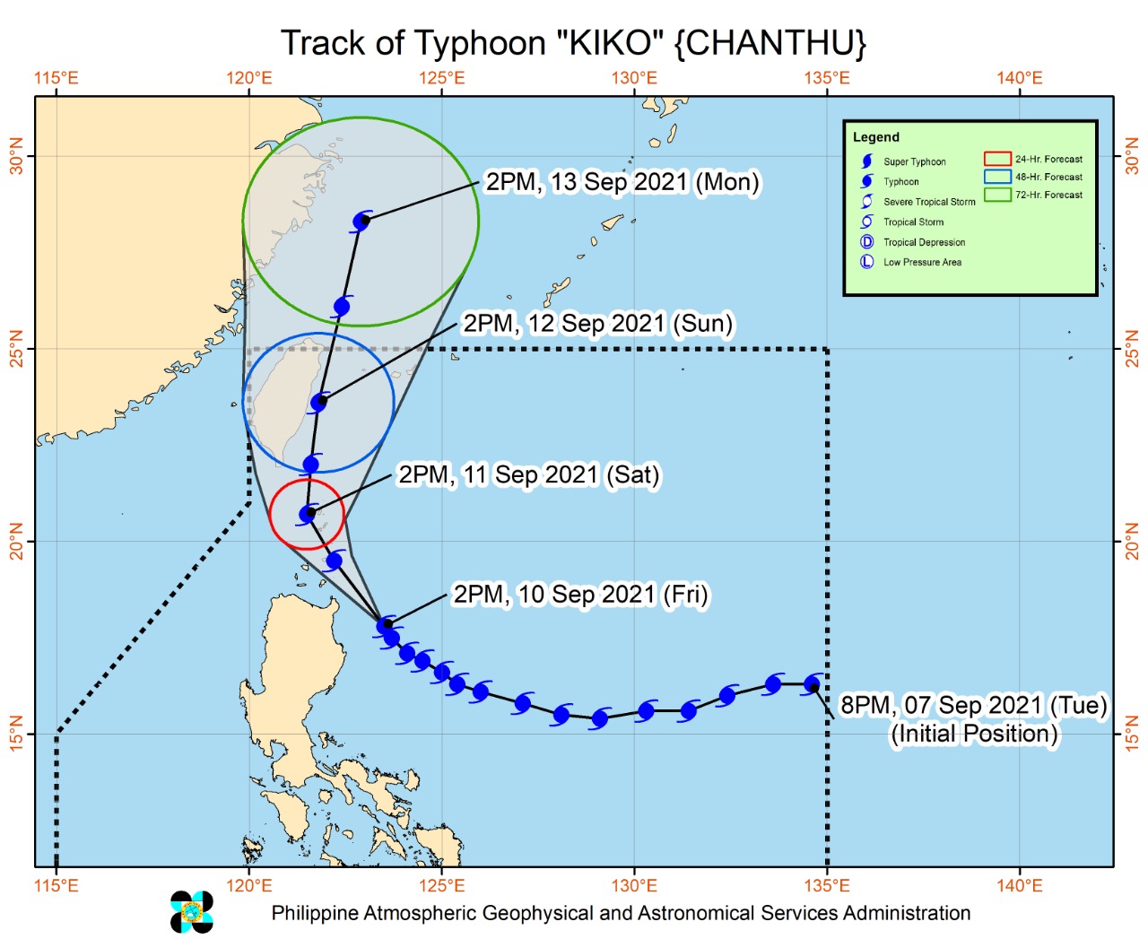
The Philippine Atmospheric, Geophysical and Astronomical Services Administration (Pagasa), in its 10:00 p.m. update said Kiko was last spotted 135 kilometers east southeast of Calayan, Cagayan and moving northwest at 20 kilometers per hour with maximum sustained winds of 215 kilometers per hour (kph) near the center, and gustiness of up to 265 kph.
“Further intensification into Super Typhoon is not ruled out. As such, TCWS #5 may be hoisted over some municipalities of Batanes and Babuyan Islands,” Pagasa said.
Other areas are under lower tropical cyclone wind signals.
Signal No. 3:
- extreme northeastern portion of Cagayan (Santa Ana, Gonzaga)
- the rest of Babuyan Islands
Signal No. 2:
- The northern, central, and eastern portions of mainland Cagayan (Aparri, Camalaniugan, Lal-Lo, Gattaran, Baggao, Peñablanca, Buguey, Santa Teresita, Tuguegarao City, Iguig, Amulung, Alcala, Lasam, Ballesteros, Abulug, Allacapan, Claveria, Santa Praxedes, Sanchez-Mira, Pamplona, Santo Niño)
- northeastern portion of Isabela (San Pablo, Maconacon, Divilacan, Palanan), and the northern portion of Apayao (Calanasan, Luna, Pudtol, Flora, Santa Marcela)
Signal No. 1
- the rest of mainland Cagayan, the northern portion of Ilocos Norte (Pagudpud, Adams, Dumalneg, Bangui, Vintar, Carasi, Nueva Era, Piddig, Solsona, Burgos, Pasuquin, Bacarra, Laoag City, San Nicolas, Sarrat, Dingras)
- the rest of Apayao
- northern portion of Kalinga (Balbalan, Pinukpuk, City of Tabuk, Rizal), the eastern portion of Mountain Province (Paracelis)
- northeastern portion of Abra (Tineg, Lacub, Malibcong)
- northwestern and southeastern portions of Isabela (Dinapigue, Palanan, San Mariano, City of Cauayan, Cabatuan, Aurora, Luna, Benito Soliven, Naguilian, Reina Mercedes, Ilagan City, Quezon, Burgos, Tumauini, San Manuel, Santo Tomas, Roxas, Santa Maria, Mallig, Quirino, Cabagan, Delfin Albano, Gamu)
Landfall unlikely
Pagasa added that the typhoon is not likely to make landfall as it would continue its northwest movement towards Taiwan. By Saturday afternoon, it may already be over the waters of Itbayat, Batanes.
On Sunday afternoon, it is forecast to be 70 kilometers north of Itbayat and may exit the Philippine area of responsibility between Sunday night and Monday morning.
Rain alert, rough seas warning
Intense to torrential rains and strong winds are expected in Cagayan and Babuyan Islands, while heavy to intense rains are expected in the northern part of Isabela and the rest of Cagayan.
Kiko will likewise intensify the effects of the southwest monsoon or “habagat”, causing strong winds and rain in the western section of Central Luzon, Southern Luzon, and the Visayas in the next 24 hours.
Moderate to heavy rains and at times intense rains are possible in the Ilocos region, Cordillera Administrative Region, northern and central Aurora, and the rest of Cagayan Valley.
Pagasa also reminded people living in coastal areas about the possibility of storm surges due to strong waves and winds brought by the typhoon.
Sea travel is also not advised in areas under various tropical cyclone wind signals as waves may range from 2.5 meters to as high as 10 meters.