Typhoon Kiko nears land; TS Jolina may exit PAR on Thursday night
From Pagasa wesbite
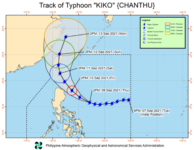
MANILA, Philippines — Typhoon Kiko (international name: Chanthu) continues to move west-northwest over the Philippine Sea east of Aurora and may likely hit land over Cagayan on Friday, the state weather service said.
This developed as Tropical Storm Jolina moves further away and may possibly exit the Philippine Area of Responsibility (PAR) by Thursday night, according to the Philippine Atmospheric, Geophysical and Astronomical Services Administration (Pagasa).
Kiko was last spotted 550 kilometers east of Baler, Aurora, packing maximum sustained winds of 195 kilometers per hour (kph) near the center and gusts of up to 240 kph, Pagasa said. It is heading west-northwest at 20 kph.
The state weather bureau also noted that the typhoon’s wind extends up to 200 km from its center or its eye.
Although the effects of Kiko would not be immediately felt, Pagasa hoisted Tropical Cyclone Wind Signal No.1 over the following areas:
- Batanes
- Cagayan
- Babuyan Islands
- The Northeastern portion of Apayao (Luna, Pudtol, Flora, Santa Marcela)
- The Northeastern portion of Isabela (Santa Maria, San Pablo, Maconacon, Divilacan, Palanan)
It explained that raising the signal was meant to alert local governments and residents on the typhoon’s path to carry out necessary preparations.
“Subalit hindi naman po agad-agad na mararamdaman, ito po ay bilang pagbibigay ng paghahanda dito sa mga kababayan natin dito sa mga nabanggit na lugar para sa mga posibleng epekto ng bagyong si Kiko na mararanasan in the next 36 hours or less,” said Pagasa senior weather specialist Chris Perez.
Perez then warned that Kiko’s landfall may possibly be in the northeastern part of Cagayan on Friday.
“That is why pinaghahanda natin hindi lamang itong Cagayan, hindi lamang ang dulong Hilagang Luzon. Subalit maghanda rin itong bandang Isabela area, sa posibleng paglapit ng bagyong si Kiko,” he pointed out.
(That is why we are advising not only Cagayan, not only the end-North Luzon. The Isabela area should also prepare for the possible approach of typhoon Kiko.)
Starting Friday afternoon or within the next 36 hours, heavy to intense with at times torrential rains may be experienced over Cagayan including Babuyan Islands, Batanes, and northern Isabela due to the typhoon, Pagasa said.
The rest of Isabela, on the other hand, will experience moderate to heavy with at times intense rains because of Kiko, it added.
By Sunday, the state weather service said, Kiko may exit the Philippine Area of Responsibility.
From Pagasa wesbite
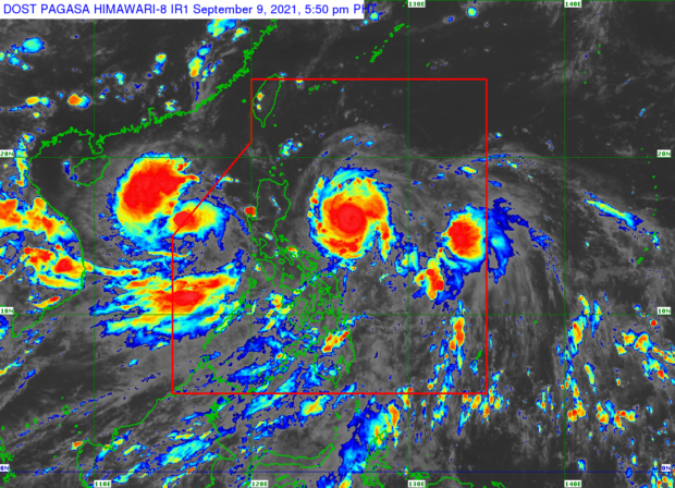
As for Jolina, Pagasa said the tropical storm was last spotted 410 km West of Dagupan City, Pangasinan, packing maximum sustained winds of 85 kph and gustiness of up to 105 kph. Pagasa also said that Jolina has been enhancing the prevailing southwest monsoon in the western portion of Luzon, Visayas, and Mindanao.
“Bagamat patuloy iyong kumikilos palabas ng ating bansa, at posibleng lumabas ng PAR ngayong gabi, patuloy naman itong nagpapaibayo ng habagat dito sa kanlurang bahagi ng Timog Luzon, ng Kabisayaan at ng Mindanao,” said Perez.
(Although it continues to move out of the country, and possibly out of PAR tonight, it continues to intensify the southwest monsoon here in the western part of Southern Luzon, Visayas, and Mindanao.)
“Ngayong hapon o mamayang gabi ay inaasahan tuluyan na itong lalabas sa northwestern boundary ng ating PAR,” he added.
(Jolina is anticipated to finally exit through the northwestern boundary of PAR this late Thursday afternoon or late Thursday night.)
KGA
