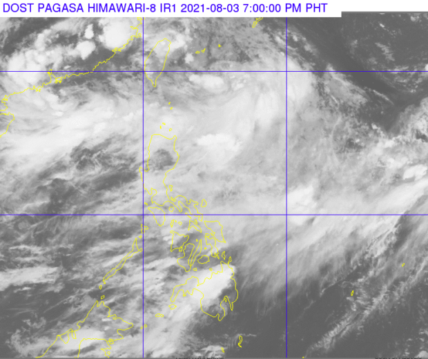
MANILA, Philippines — Weather forecasters are monitoring a low-pressure area (LPA) off Batanes that is expected to strengthen into a tropical depression, while moving toward the northeast direction.
As of 3 p.m. on Tuesday, the weather disturbance was estimated at 580 kilometers northeast of Itbayat, Batanes, said the Philippine Atmospheric, Geophysical and Astronomical Services Administration (Pagasa).
The weather service said the LPA may develop into a tropical depression until Thursday, as it moves toward the northern boundary of the Philippine territory.
Pagasa forecasters are also monitoring two tropical depressions outside the country’s area of responsibility. As of Tuesday afternoon, one was at 3,025 km east northeast of extreme Northern Luzon, while the other was at 850 km west of extreme Northern Luzon.
The southwest monsoon, however, remains the dominant weather system affecting the country, bringing rain over most of Luzon on Wednesday.
Residents in Ilocos region, Batanes, Babuyan Islands, Abra, Apayao, Benguet, Zambales and Bataan provinces should brace for monsoon rain that can trigger flash floods and landslides.
Metro Manila, the provinces of Tarlac, Pampanga, Bulacan, Cavite, Batangas, Rizal, Occidental Mindoro, Oriental Mindoro and Palawan, and the rest of Cordillera and Cagayan Valley may experience occasional rain also due to the “habagat.”
