Expect continuous monsoon rains as Fabian moves northwest slowly
PAGASA
MANILA, Philippines — Typhoon Fabian’s slow northwestward movement and prolonged stay within the Philippine area of responsibility (PAR) may not bode well for the country as it continues to intensify the southwest monsoon or habagat.
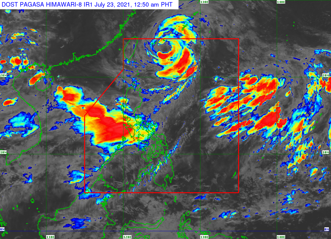
Satellite images shared by the Philippine Atmospheric, Geophysical and Astronomical Services Administration (Pagasa) late Thursday night showed thick clouds over a huge portion of Luzon, bringing strong rain showers over Central Luzon, Southern Luzon, including Metro Manila.
Fabian, still packing maximum sustained winds of 150 kilometers per hour (kph) near the center and gustiness of up to 185 kph, is also still pulling the southwest monsoon onto the country.
“So ito pong bagyong ito ay patuloy pa rin po niyang pinapa-enhance ‘yong ating hanging habagat or southwest monsoon na nakaka-apekto po ‘yan sa malaking bahagi ng ating bansa,” weather specialist Shelly Ignacio said.
(So this typhoon continues to intensify and enhance our southwest monsoon, which in turn affects a huge part of the country.)
Article continues after this advertisement“Asahan pa rin po natin ang kalat-kalat at malawakang pag-ulan or mga monsoon rain na in the next 24 hours po mararanasan dito sa may Ilocos Region, sa may Cordillera Administrative Region, Metro Manila, and sa malaking bahagi po ng Calabarzon, gayundin po dito sa Central Luzon and then sa ilang portion po ng Mimaropa,” she added.
Article continues after this advertisement(We can still expect isolated and widespread rains or monsoon rains in the next 24 hours over the Ilocos Region, Cordillera Administrative Region, Metro Manila, and huge parts of Calabarzon, Central Luzon and then some portions of Mimaropa.)
The typhoon was last seen 515 kilometers northeast of Itbayat, Batanes, with strong winds extending outwards up to 630 kilometers from the center.
As a result, Pagasa maintained a Yellow Heavy Rainfall Warning over Metro Manila, Zambales, Bataan, Cavite, and Batangas — which means that flooding is possible in these areas while landslides may occur near mountain slopes identified as hazard areas.
Earlier, Oriental Mindoro was placed under a Red Heavy Rainfall Warning, indicating that severe flooding is expected in flood-prone areas and those near river channels, while Marinduque, Romblon, and La Union towns of Luna, Balaoan, and Bacnotan are under a Yellow Warning.
Tropical Cyclone Wind Signal No. 1 remains up in Batanes and the Babuyan Group of Islands.
Pagasa expects Fabian to reach its peak intensity with maximum sustained winds of 165 kph by Friday evening, by which it would be 505 kilometers northeast of Itbayat.
Between Friday night and Saturday morning, it is predicted that Fabian would leave PAR while moving north northwest, approaching the eastern part of China. It may make landfall over China by Sunday evening, and eventually weaken to a tropical storm on Monday, and then a tropical depression by Tuesday.
The entire seaboards of Luzon and Visayas are still under a gale warning, which means sea travel would be risky for small boats.