
Track of typhoon Fabian from Pagasa website
MANILA, Philippines — Severe Tropical Storm Fabian has strengthened into a typhoon on Tuesday afternoon, according to the Philippine Atmospheric, Geophysical and Astronomical Services Administration (Pagasa).

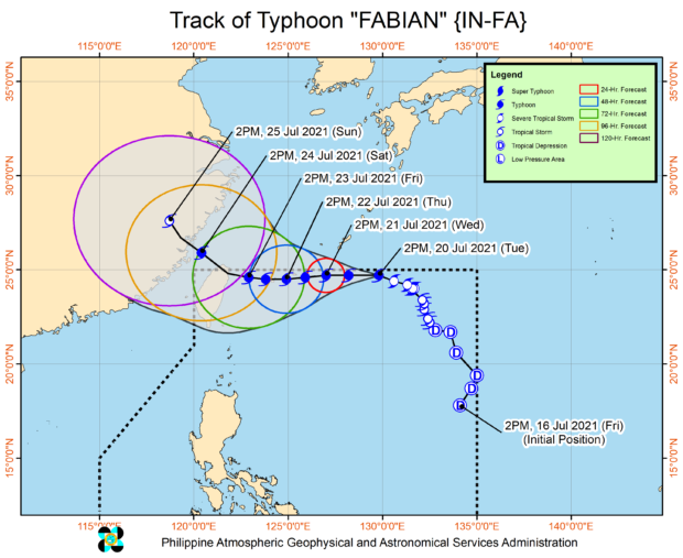
Pagasa, in its 5 p.m. weather bulletin, said Fabian intensified into a typhoon at 2:00 p.m. with its eye last spotted 895 kilometers (km) east-northeast of extreme Northern Luzon, packing maximum sustained winds of 120 km per hour (kph) and gustiness of up to 150 kph, moving west-northwestward at 15 kph.
The state weather service noted that Fabian brings strong winds that extend outwards up to 600 km from the center.
Although Fabian is unlikely to cause heavy rainfall in the country throughout the forecast period, Pagasa said the latest forecast scenario shows there would be a strong possibility that Tropical Cyclone Wind Signal No. 1 may be raised over Batanes and Babuyan Islands.
“Residents and disaster managers in Batanes and Babuyan Islands are advised to continuously monitor the tropical cyclone bulletins,” advised Pagasa.
The typhoon will move westward until Friday.
“The latest track forecast shows an increasing likelihood of landfall in the vicinity of northern Taiwan by Friday evening or Saturday early morning – the same time period Fabian may exit the Philippine Area of Responsibility (PAR),” said Pagasa.
Pagasa warned that Fabian is expected to further intensify and reach its peak intensity of 155 kph on Thursday evening or Friday early morning.