MANILA, Philippines — Two weather systems on both sides of the Philippines gained strength on Monday, further enhancing the southwest monsoon that will bring rain across the country on Tuesday, the weather service said.
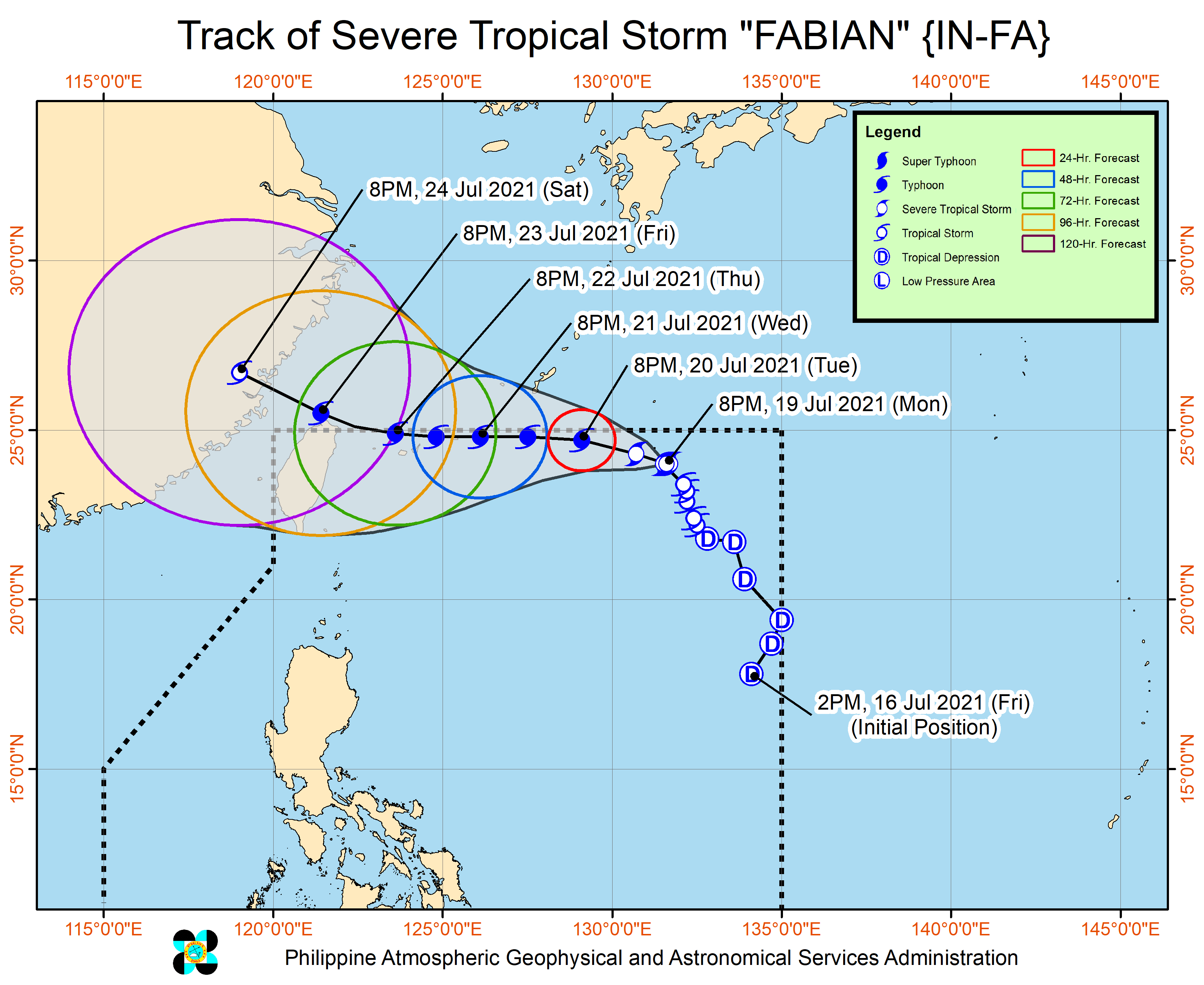
Tropical Storm “Fabian” (international name: In-fa) intensified into a severe tropical storm, while remaining almost stationary 1,075 kilometers east northeast of extreme northern Luzon on Monday afternoon, said the Philippine Atmospheric, Geophysical and Astronomical Services Administration (Pagasa).
The storm packed winds of up to 95 km per hour and gusts of up to 115 kph. Because of its almost stationary movement, it is expected to linger a bit longer within the Philippine territory and may exit on Thursday.
On Tuesday, Fabian is expected to reach typhoon category, reaching its peak intensity by Wednesday evening or early Thursday. But it is still unlikely to bring heavy rainfall in the country throughout the forecast period due to its distance from the Philippine landmass.
Pagasa is also monitoring Tropical Storm “Cempaka,” which remained outside of the country’s area of responsibility, as of Monday afternoon.
Its center was seen 930 km west of extreme northern Luzon at 3 p.m. on Monday. It blew winds of up to 75 kph near the center and gusts of up to 90 kph.
It moved toward the northwest direction, forecasters said.
Fabian and Cempaka are both enhancing the southwest monsoon, locally known as “habagat,” which will bring monsoon rain in Ilocos region and the provinces of Zambales, Bataan, Occidental Mindoro and Palawan.
Cloudy skies with scattered showers and thunderstorms will prevail in Metro Manila and the rest of the country. INQ