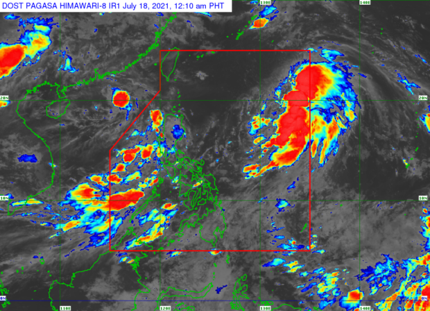
The Philippine Atmospheric, Geophysical and Astronomical Services Administration (Pagasa) said it was unlikely that Fabian would bring heavy rainfall in the country.
But Fabian was enhancing the southwest monsoon, locally known as “habagat.”
Pagasa added that the habagat might bring rain in Palawan and Occidental Mindoro within 24 hours.
Based on the forecast track of the storm, Pagasa said they would closely monitor the critical period from Monday to Wednesday as the habagat could be enhanced, resulting in rain over a big part of the western section of the country.
As of Saturday afternoon, Fabian was located 1,205 kilometers east of extreme northern Luzon. Its maximum sustained winds clocked in at 55 km per hour and gusts of up to 70 kph.
The weather disturbance was heading northwest at a speed of 20 kph.
While Fabian is forecast to strengthen into a tropical cyclone in the next 12 hours, it is not expected to make a close approach to the Philippine land mass.
Fabian is forecast to exit the Philippine area of responsibility on Monday afternoon or late evening. INQ