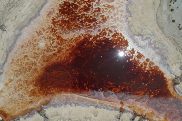
An aerial view shows an almost evaporated canal, with toxic residues, as California faces its worst drought since 1977, in Salton City, California, U.S., July 4, 2021. REUTERS
Drone footage taken at the Salton Sea, California’s largest inland lake, shows the dramatic effects of the state’s worst drought since 1977.
Its receding shoreline has caused an ecological crisis as exposed silt is carried into surrounding areas.
From the air, brown furrowed fields stretch as far as the eye can see and the sun beats down on an almost evaporated canal that looks like a gaping wound. Dusty former boat launches have fallen into disuse, too far from the waters they once served.
Drought has scorched much of the U.S. West, prompting farmers in California to leave fields fallow and triggering water and energy rationing in several states.
RELATED STORIES
California already in throes of drought as summer looms
Drought-hit California scales up plan to truck salmon to ocean