
Source: Pagasa DOST
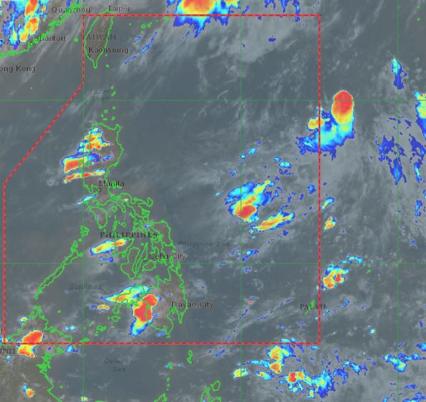
MANILA, Philippines — The southwest monsoon’s effects over the country remain minimal, but state meteorologists are currently monitoring a low-pressure area (LPA) that may enter the Philippine area of responsibility (PAR) in the coming hours.
Weather updates from the Philippine Atmospheric, Geophysical, and Astronomical Services Administration (Pagasa) on Wednesday showed that the LPA, last located 1,590 kilometers east of extreme Northern Luzon, also has a huge chance of developing into a tropical cyclone.
If it intensifies into a storm, it would be given the local name “Emong,” and would likely be the first of three cyclones in July. However, Pagasa also does not expect the cyclone to affect local weather, as it may dissipate over the Philippine Sea.
In the meantime, Pagasa said that weather conditions over Luzon on Thursday would continue to be warm and humid due to the weak southwest monsoon or habagat, with isolated rain showers possible by afternoon and night.
Due to this, temperatures over Metro Manila may play between 25 to 34 degrees Celsius, Legazpi with 26 to 34 degrees, Laoag and Puerto Princesa with 25 to 33 degrees, Tagaytay with 23 to 31 degrees, Baguio with 16 to 27 degrees, and Tuguegarao with 24 to 37 degrees.
Similar humid conditions would also prevail over Visayas and Mindanao, which would lead to somewhat high temperatures of 26 to 33 degrees Celsius over Iloilo and Tacloban, 25 to 33 degrees in Cebu, and Davao, 24 to 33 degrees in Zamboanga, and 24 to 34 degrees in Cagayan de Oro.
No gale warning has been raised over any part of the country, but sea conditions over Luzon’s northern and western seaboards would be moderate. The rest of the country’s coastlines would have a slight to moderate condition.