

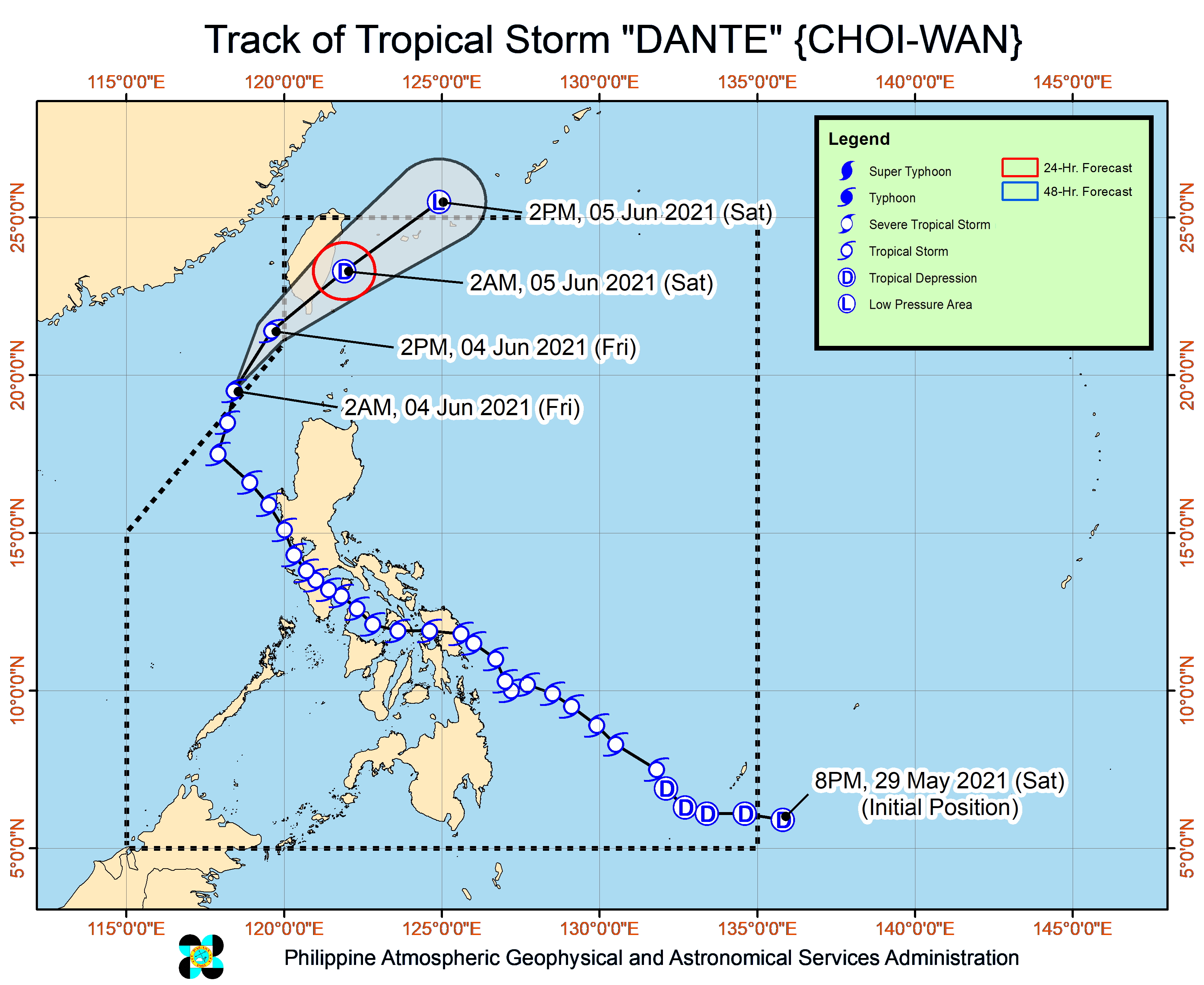
Dante was last spotted 260 km west-northwest of Sinait, Ilocos Sur, moving north at 20 kph with maximum sustained winds of 65 kilometers per hour (kph) and a gustiness of up to 80 kph.
Dante may leave PAR momentarily as it moves north and then reenter it as it shifts to the northeast, towards the southern part of Taiwan.
Contrary to an earlier prediction, Dante will probably remain a tropical storm once it re-enters PAE on Friday morning, by which time it would be 320 km west of Basco, Batanes.
By Friday night, it would be 210 km northwest of Itbayat, Batanes, or just over the coastal waters of Taiwan’s Pingtung County, where it may make a brief landfall.
On Saturday morning, it would be 400 km north northeast of Itbayat, or over the coastal waters of Japan’s Yonaguni Islands, as a weakened tropical depression.
Dante has ceased to have a direct effect on the country, but a gale warning remains up on the northern and western seaboards of Luzon, particularly from Ilocos Region up to Batanes, and some parts of Cagayan.
Fisherfolk and small boat operators are not allowed to set sail as sea conditions would range from rough to very rough.
