MANILA, Philippines — Twelve areas are now under Tropical Cyclone Wind Signal (TCWS) No. 2 as tropical storm Dante moved northwest of Romblon, the state weather service said on Wednesday.
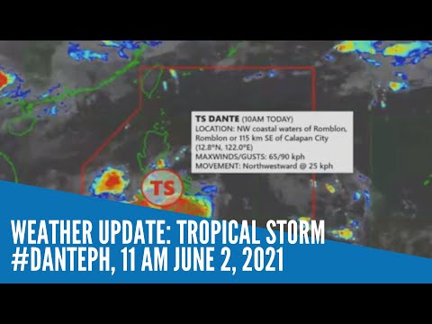
In its latest bulletin, as of 11 a.m, Philippine Atmospheric, Geophysical and Astronomical Services Administration (Pagasa) weather forecaster John Rojas said Dante was last spotted over the northwestern coastal waters of Romblon, Romblon or 115 km Southeast of Calapan City, Oriental Mindoro.
It packed a maximum sustained winds of up to 65 kilometers per hour (kph) and gustiness of up to 90 kph. It was moving northwest at a speed of 25 kph.
Pagasa hoisted TCWS No. 2 in 12 areas in which strong winds to gale-force winds could be expected within 24 hours:
- Romblon
- Marinduque
- Northern and Central Oriental Mindoro (Roxas, Bongabong, San Teodoro, Puerto Galera, Baco, City of Calapan, Naujan, Victoria, Socorro, Pola, Pinamalayan, Gloria, Bansud)
- Northern and Central Occidental Mindoro (Sablayan, Santa Cruz, Paluan, Mamburao, Abra de Ilog, Lubang Islands)
- Batangas
- Cavite
- Bataan
- Southwestern Bulacan (Calumpit, Bulacan, City of Malolos, Paombong, Hagonoy)
- Western Pampanga (Masantol, Macabebe, Sasmuan, Lubao, Floridablanca, Porac, Guagua, Santa Rita, Angeles City, Mabalacat City, Minalin, Bacolor)
- Zambales
- Western Tarlac (Bamban, Capas, San Jose, Mayantoc, Camiling, Santa Ignacia, San Clemente)
- Western Pangasinan (Bolinao, Anda, Bani, Agno, Burgos, Infanta, Dasol, City of Alaminos, Mabini, Sual, Labrador, Bugallon, Aguilar, Mangatarem, Bayambang, Urbiztondo, Basista, Malasiqui, San Carlos City, Santa Barbara, Mangaldan, Dagupan City, Calasiao, Binmaley, Lingayen)
“Light to moderate damage” to structures and vegetation should be expected in these areas, said Pagasa.
The state weather service also raised signal No.1 in Luzon and Visayas, meaning, strong breeze to near gale conditions may be experienced, especially in coastal and mountainous areas.
Signal No. 1 may bring “generally very light damage” to structures and vegetation.
Luzon:
- Metro Manila
- Rizal
- Western and Central Laguna (Luisiana, Pagsanjan, Santa Cruz, Majayjay, Magdalena, Liliw, Nagcarlan, Pila, Victoria, Rizal, San Pablo City, Calauan, Bay, Alaminos, Los Baños, City of Calamba, Cabuyao City, City of Santa Rosa, City of Biñan, City of San Pedro)
- Western Quezon (Lucena City, City of Tayabas, Pagbilao, Lucban, Sariaya, Candelaria, Dolores, Tiaong, San Antonio, Padre Burgos)
- The rest of Oriental Mindoro
- The rest of Occidental Mindoro
- Calamian Islands and Cuyo Islands, Palawan
- The rest Bulacan
- The rest of Pampanga
- The rest of Tarlac
- Western Nueva Ecija (Cabiao, San Antonio, City of Gapan, San Isidro, San Leonardo, Jaen, Zaragoza, Licab, Guimba, Cuyapo, Nampicuan, Talugtug, Quezon, Aliaga, Santa Rosa)
- The rest of Pangasinan
- Southern Benguet (Itogon, Tuba, Sablan, Baguio City, La Trinidad, Kapangan, Tublay)
- La Union
Visayas:
- Aklan
- Capiz
- Northern Antique (Valderrama, Bugasong, Laua-An, Barbaza, Tibiao, Culasi, Sebaste, Pandan, Libertad, Caluya)
- Northwestern Iloilo (Lambunao, Calinog, Bingawan)
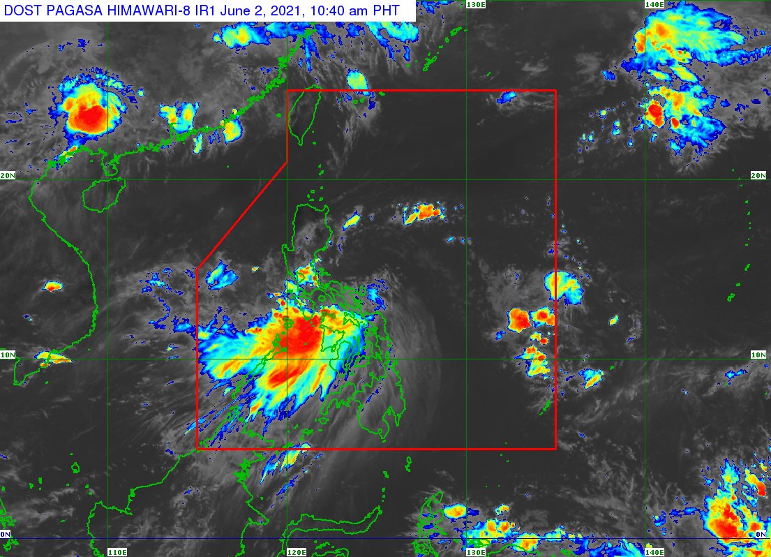
Satellite image of TS Dante. Image from Pagasa
No storm signals, on the other hand, are raised in Mindanao.
Aside from the storm signals, Rojas said moderate to heavy with at times intense rains is expected over the next 24 hours in CALABARZON, Romblon, Marinduque, Occidental Mindoro, Oriental Mindoro, Aklan, Antique, Capiz, Iloilo, Guimaras, Zambales, and Bataan.
Moderate to heavy rains are also expected in Tarlac, Pampanga, Bulacan, Metro Manila, the northern portion of Palawan including Calamian, Cuyo, and Cagayancillo Islands, and Negros Occidental.
While light to moderate with at times heavy rains is expected over the rest of Central Luzon, Benguet, Nueva Vizcaya, Quirino, the rest of MIMAROPA, Negros Oriental, and Cebu including Camotes and Bantayan Islands.
“Dahil po dito, mayroon po tayong aasahang kalat kalat hanggang sa mga malawakang pagbaha, kasama ang flashfloods diyan at ang rain-induced landslides,” said Rojas.
(Because of this, we can expect widespread flooding, including flash floods and rain-induced landslides.)
“Ang ating mga kababayan na nakatira sa mababang lugar ay pinagiingat, laban sa mga nabanggit na hazards (Our countrymen living in low -lying areas are advised to take extra care against the aforementioned hazards),” he added.
Rough to very rough seas with waves reaching 2.5 to 4 meters are also expected in areas under Signal No. 2.
“Bawal po muna pumalaot ‘yung ating mga kababayang mangingisda, at may mga maliliit na sasakyang pandagat sa lahat ng lugar under Tropical Cyclone Wind Signal No. 2, dahil sa matataas na alon,” said Rojas.
(Fishermen as well as small boat owners are not allowed to sail in areas under Tropical Cyclone Wind Signal No. 2, due to high waves.)
Meanwhile, moderate to rough seas with waves reaching 1.2 to 3 meters are expected in areas under Signal No. 1.
According to Pagasa, Dante will maintain its strength until it makes landfall over mainland Luzon.
It will then be downgraded into a tropical depression by Thursday due to its further interaction with the rugged terrain of Luzon.