Pagasa: Expect 1 to 3 storms in June

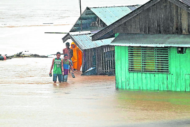
FLEEING DANGER Residents retrace a pathway submerged by the swollen Tandag River in Tandag City, Surigao del Sur, as they seek safer ground during the onslaught of Tropical Storm “Auring” in February. —ERWIN MASCARIÑAS
MANILA, Philippines — Around one to three tropical cyclones may enter the Philippine area of responsibility (PAR) for the month of June, the Philippine Atmospheric, Geophysical and Astronomical Services Administration (Pagasa) said on Thursday.
“Ngayong buwan po ng Hunyo 2021 ayon po sa forecast ng ating climate monitoring section, isa o tatlong bagyo ang posibleng pumasok sa loob sa Philippine area of responsibility,” weather specialist Ariel Rojas said during Pagasa’s afternoon forecast.
According to Rojas, the state weather bureau’s climatology department has seen two possible tracks for cyclones entering in June, based on past years’ data.
One would see the cyclone entering the PAR from the Pacific Ocean, east of Mindanao or Visayas, before taking on a northwest path that would put Central and Eastern Visayas, Southern Luzon, Bicol Region, Metro Manila, and Central Luzon on its crosshairs.
The other possible track would see storms entering PAR east of Bicol Region, then make an approach towards Cagayan Valley, before recurving back to the Pacific Ocean or towards Japan’s eastern waters.
Article continues after this advertisement“Sa atin pong climatological tracks ng mga bagyong nagdaan sa buwan ng Hunyo mula 1948 to 2017, ay may dalawang scenario po tayong nakikita. Una po, ay ang pagtama sa lupa, sa gitnang bahagi ng ating bansa, patawid sa West Philippine Sea,” Rojas said.
Article continues after this advertisement“At ang pangalawang scenario naman ay ang pagliko, hindi po maglalandfall ito, kung hindi nasa Philippine Sea lamang at liliko pabalik sa Dagat Pasipiko or patungo sa may Japan,” he added.
Still, Pagasa reminded people to monitor weather updates as cyclone tracks may become erratic and change according to conditions present.
As of now, no weather disturbance is being observed inside the PAR, but state meteorologists have pinpointed a low-pressure area (LPA) east of Mindanao. It may enter the country’s periphery between Saturday and Sunday, although it is not yet seen to intensify into a tropical depression.
On Wednesday, Pagasa Climate Monitoring and Prediction Section chief Ana Liza Solis said that the country may be one or two weeks away from the rainy season, despite the recent streak of hot and humid weather.
Solis noted that it is possible that a storm or even an LPA can trigger the onset of the southwest monsoon or habagat, which brings rains to the country.