Typhoon Bising slightly weakens but still affects east Luzon
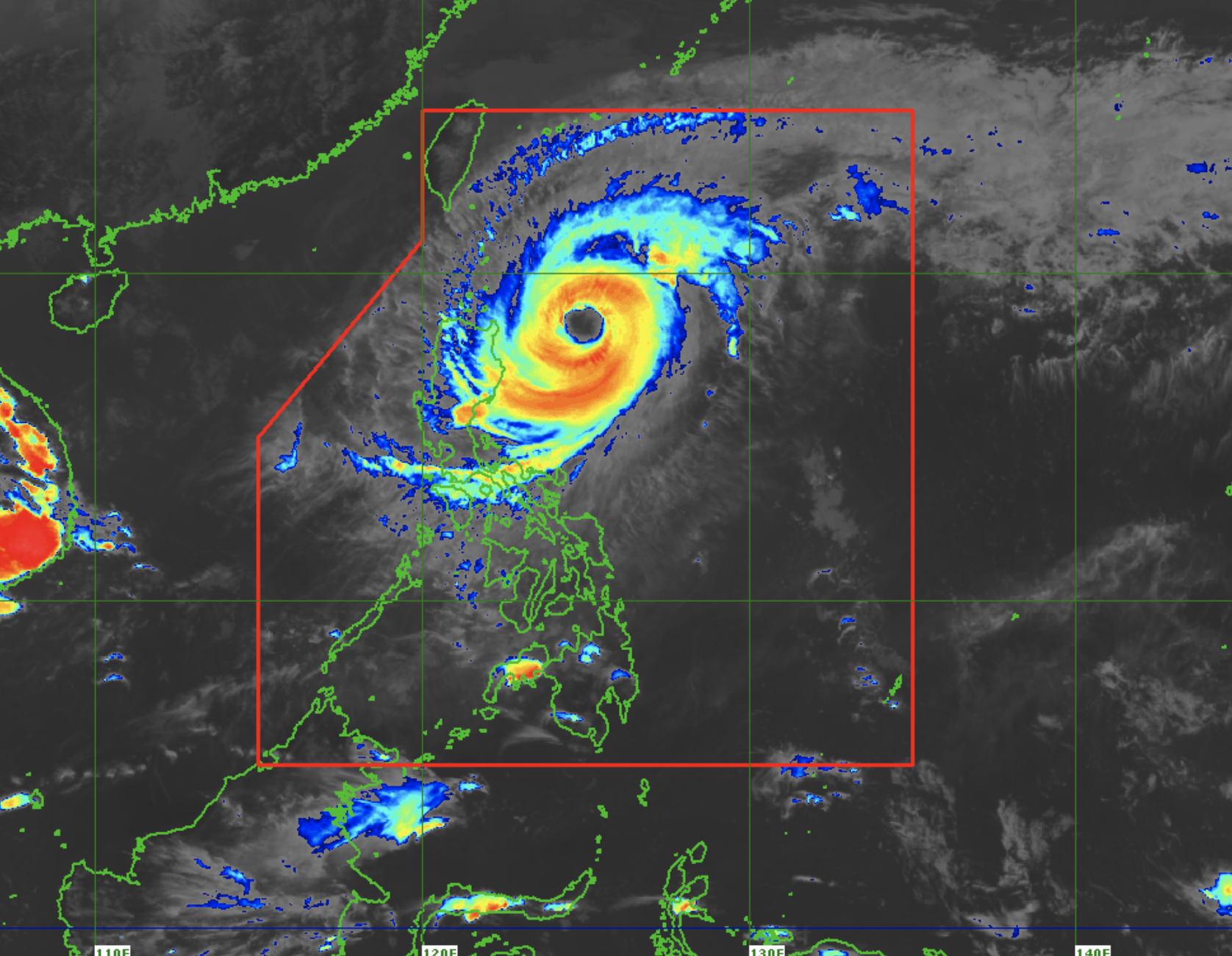
Satellite image/Himawari IR1 via Pagasa
MANILA, Philippines — Typhoon Bising lost some strength as it continued its northern path on Wednesday afternoon, state weather officials said.

Latest updates from the Philippine Atmospheric, Geophysical and Astronomical Services Administration (Pagasa) showed that Bising was last located 345 kilometers east of Aparri, Cagayan.
It is still a typhoon category cyclone, packing maximum sustained winds of 165 kilometers per hour (kph) near the center and gustiness of 215 kph. It is moving northward at a speed of 15 kph.
This means areas such as Cagayan Valley, Cordillera Administrative Region, and even Ilocos province could still feel the effects of the typhoon, with large gusts of wind that can vary from breeze to gale conditions.
Pagasa said Bising should begin recurving towards the Pacific after Thursday afternoon, when it would be 335 kilometers east of Basco, Batanes. On Friday, Bising would be already 695 kilometers east of Itbayat, Batanes.
Pagasa’s latest forecast shows Bising leaving by Saturday or Sunday morning.
Wind signals have been lifted in areas no longer affected by the weather disturbance, but a Tropical Cyclone Wind Signal No. 1 remains in effect in the following areas in Luzon:
Batanes, including Babuyan Islands
eastern portion of Cagayan (Santa Ana, Gonzaga, Lal-Lo, Gattaran, Baggao, Peñablanca, Camalaniugan, Buguey, Aparri, Santa Teresita, Alcala, Amulung, Iguig, Tuguegarao City)
eastern portion of Isabela (San Pablo, Maconacon, Divilacan, Tumauini, Cabagan, Palanan, Dinapigue, San Guillermo, Benito Soliven, San Mariano, Ilagan, Gamu, Naguilian)
As a result of Bising moving up north, more areas are expected to have better weather conditions in the coming days. For Thursday, only Northern Luzon would be affected by Bising, which would lead to lower temperatures like in Tuguegarao with 22 to 29 degrees Celsius, 24 to 32 degrees in Laoag, and 16 to 24 degrees in Baguio City.
On the western and southern parts of Luzon, warm and humid days may be felt with a chance of rain by afternoon and night. Metro Manila may have temperatures of 24 to 33 degrees, Legazpi with 25 to 31 degrees, Tagaytay with 21 to 31 degrees, and Puerto Princesa with 25 to 33 degrees.
For Visayas and Mindanao, good weather conditions would prevail, with 24 to 32 degrees Celsius over Tacloban and Cagayan de Oro, 26 to 32 degrees in Cebu, 25 to 32 degrees in Iloilo, and 24 to 34 degrees in Zamboanga and Davao.
Any form of sea travel is still banned in areas under a Tropical Cyclone Wind Signal No. 1, and for the whole seaboard of Ilocos Region, up to Batanes, then down to Cagayan Valley, eastern parts of Central and Southern Luzon, to the waters north of Bicol Region.