Signal No. 2 up in Catanduanes, Samar provinces due to Typhoon Bising
MANILA, Philippines — Tropical Cyclone Wind Signal (TCWS No. 2) was raised over Catanduanes, Northern Samar, Eastern Samar, and Samar on Saturday as Typhoon Bising slightly accelerates and intensifies.
According to the Philippine Atmospheric, Geophysical and Astronomical Services Administration (Pagasa), winds of greater than 61 kilometers per hour and up to 120 kilometers per hour may be expected in at least 24 hours in areas under TCWS No. 2.
Meanwhile, TCWS No. 1 is raised in the following areas based on Pagasa’s 5 p.m. bulletin:
Luzon Sorsogon Albay eastern portion of Camarines Sur (Calabanga, Naga City, Pili, Bula, Bombon, Magarao, Canaman, Gainza, Camaligan, Milaor, Minalabac, Tinambac, Siruma, Lagonoy, Goa, Tigaon, Ocampo, Baao, Iriga City, Nabua, Balatan, Bato, Buhi, Sagnay, San Jose, Garchitorena, Presentacion, Caramoan, San Fernando) eastern portion of Masbate (Baleno, Masbate City, Mobo, Uson, Dimasalang, Palanas, Cataingan, Pio V. Corpuz) including Ticao Island
Visayas Biliran Leyte Southern Leyte Camotes Islands
Mindanao Dinagat Islands Surigao del Norte (including Siargao and Bucas Grande Islands) Surigao del Sur
Pagasa said winds of 30 to 60 kph may be expected in at least 36 hours or intermittent rains may be expected within 36 hours in areas under TCWS No. 1.
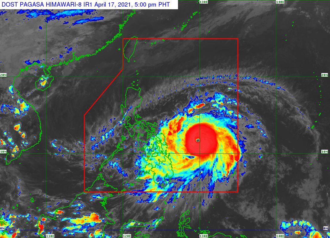
According to Pagasa, the center of the eye of Typhoon Bising was last spotted 460 km east of Guiuan, Eastern Samar.
The typhoon is moving west-northwestward at 25 kph and has maximum sustained winds of 195 kph near the center and gustiness of up to 240 kph.
Forecast track
Pagasa said Typhoon Bising will move northwestward over the Philippine Sea until Sunday afternoon. The typhoon will then slow down and move generally northward until Tuesday afternoon before moving generally northward or north-northwestward over the Philippine Sea east of Northern and Central Luzon.
“Considering the uncertainty in the track forecast of typhoon ‘Bising’, a westward shift in the current forecast track may result in potentially significant impacts over the eastern portions of Southern Luzon and Visayas,” the weather bureau said.
The typhoon is forecast to further intensify and reach its peak intensity with up to 205 kph on Sunday.
Weather forecast for Sunday, Monday
On Sunday, the rainbands of the typhoon are expected to bring moderate to heavy with at times intense rains over Eastern Visayas, Bicol Region, and the southern portion of Quezon, according to Pagasa.
By Monday, moderate to heavy with at times intense rains may be observed over Northern Samar, Bicol Region, and the southern portion of Quezon.
“Under these conditions, flooding (including flash floods) and rain-induced landslides may occur especially in areas identified in hazard maps as highly or very highly susceptible to these hazards,” Pagasa warns.