Severe Tropical Storm Surigae may enter PAR early, between Thursday night and Friday
MANILA, Philippines — Severe Tropical Storm Surigae may enter the Philippine area of responsibility (PAR) earlier than initially predicted, between Thursday night and Friday morning according to state meteorologists.
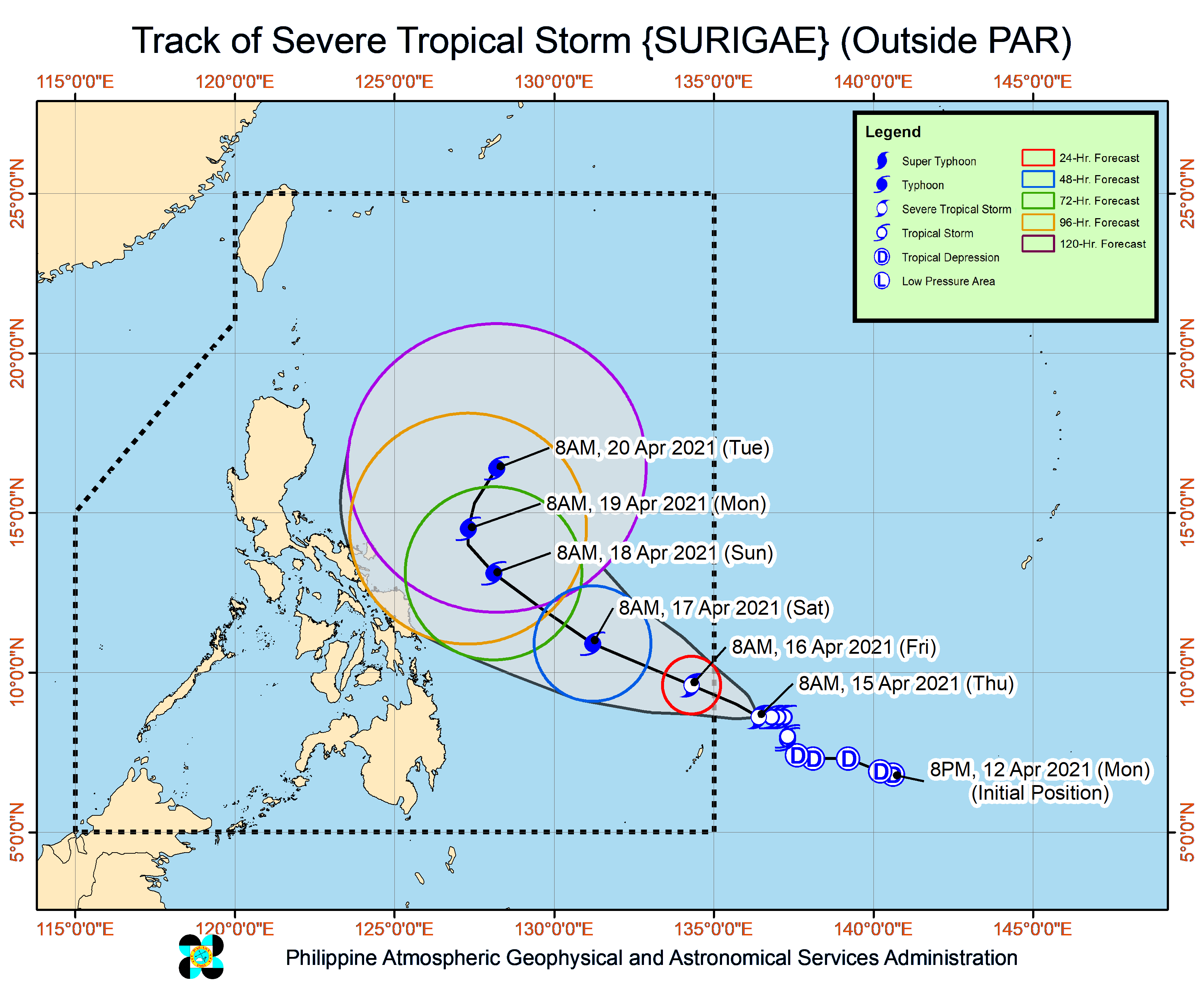
Latest updates from the Philippine Atmospheric, Geophysical and Astronomical Services Administration (Pagasa) on Thursday afternoon showed that Surigae was last located 1,140 kilometers east of Mindanao.
Surigae’s sustained winds have increased to 95 kilometers per hour (kph) near the center, while gustiness has increased to 115 kph. It is traveling slowly north northwest, which may mean that it will produce additional strength due to its prolonged stay over water.
Surigae, which would be given the local name “Bising” once it enters PAR, is still seen to intensify as a typhoon-category cyclone.
As of now, no landfall scenario is being expected, as Pagasa’s forecast track still shows that the nearest the storm would be to the landmass is by Sunday and Monday morning, where it would move to 450 kilometers east of Juban, Sorsogon; and 470 kilometers east of Daet, Camarines Norte.
Article continues after this advertisementAfter this, the typhoon may recurve back to the Pacific Ocean. However, Pagasa says that if Surigae’s diameter increases, its trough to extend all the way to Bicol Region, Southern Luzon, and even Metro Manila, bringing rains and thunderstorms between Sunday and Monday.
Article continues after this advertisementFor Friday, Surigae would still have no direct effect on Luzon, as temperatures stay warm over Metro Manila at 24 to 33 degrees Celsius, Laoag with 25 to 32 degrees, Tuguegarao with 25 to 35 degrees, Tagaytay with 21 to 30 degrees, Legazpi with 26 to 31 degrees, and Puerto Princesa with 25 to 31 degrees.
In Visayas and Mindanao, weather would also be fair, although there is an increased chance of isolated thunderstorms by afternoon and night. Temperatures across Cebu, Iloilo, and Tacloban would play between 25 to 32 degrees, Davao and Zamboanga with 24 to 33 degrees, and Cagayan de Oro with 24 to 31 degrees.
The conditions over Metro Manila are expected to continue until Saturday, but by Sunday and Monday, rains may be felt as the trough or extension of Surigae would affect Luzon’s southern parts, leading to a temperature range of just 23 to 32 degrees Celsius.
Similar transition of weather conditions is expected in Legazpi, as temperatures may drop to 24 to 32 degrees Celsius on Monday. Meanwhile, Cebu and Davao may see a drop in temperatures because of the rains as early as Saturday, at 25 to 31 degrees and 23 to 32 degrees, respectively.
No gale warning has been raised, but the country’s entire eastern seaboard would see a moderate sea condition, largely due to the weather disturbance. The rest of the country would have a slight to moderate condition.