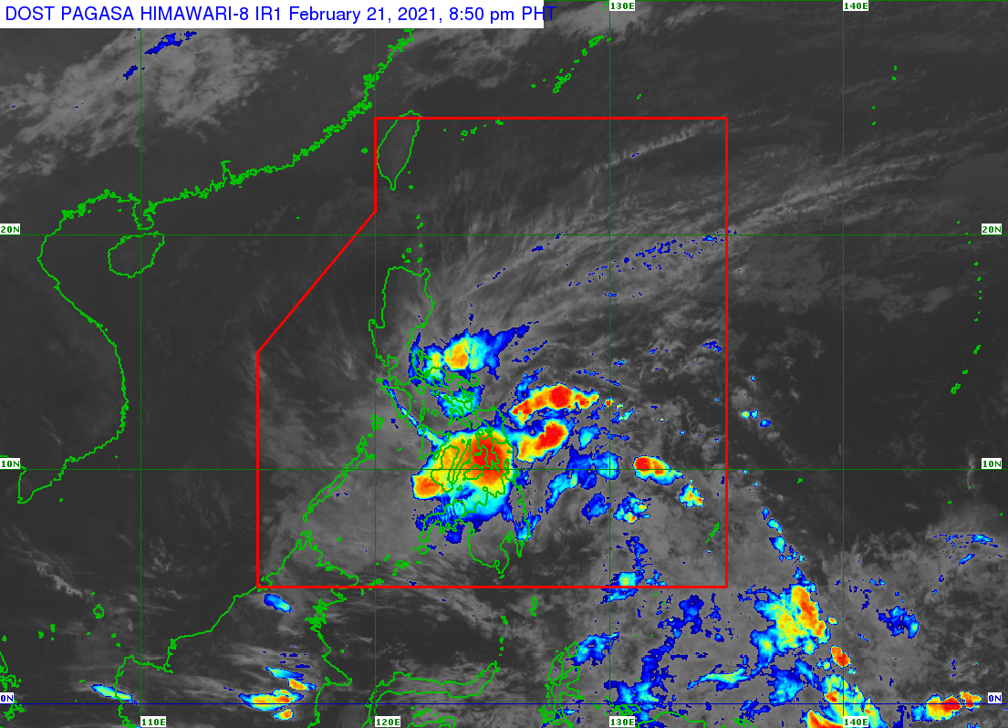
TS Auring speeds up as it nears northern tip of Caraga — Pagasa
MANILA, Philippines — Latest weather updates on Tropical Storm Auring showed that the cyclone has started to speed up as of Sunday night, moving closer to the northernmost tip of the Caraga Region.
A severe weather bulletin from the Philippine Atmospheric, Geophysical and Astronomical Services Administration (Pagasa) as of 8:00 p.m. showed that Auring is now moving northwestward at a speed of 25 kilometers per hour (kph).
Auring was last seen 275 kilometers east of Surigao City. With its current path, Pagasa said it may make landfall by Monday morning on any of the three areas: Dinagat Islands, the southern portion of Eastern Samar, or Leyte area.
Auring was able to maintain its strength, with maximum sustained winds of 65 kph and gusts of up to 80 kph. However, Pagasa remained firm that while this strength would go on for the next 12 hours, it is highly likely for Auring to weaken.
Pagasa said there is a possibility that the cyclone would hit land as a tropical depression as it moves north of Panay Island.
Article continues after this advertisementWhen it crosses the southern part of Mindoro and over the West Philippine Sea, Auring may further weaken and turn into a low-pressure area.
Article continues after this advertisement“Auring is forecast to maintain its strength in the next 12 hours. However, the likelihood of weakening into tropical depression before it makes landfall is not yet ruled out,” Pagasa said.
“After landfall, Auring is forecast to weaken considerably due to significant terrain interaction and the increasing wind shear, leading to deterioration into a remnant low within 48 hours, possibly sooner,” it added.
The following areas are still under a Tropical Cyclone Wind Signal No. 2:
- central and southern portions of Eastern Samar
- central and southern portions of Samar
- the eastern portion of Leyte
- the eastern portion of Southern Leyte
- Dinagat Islands
- Surigao del Norte including Siargao and Bucas Grande Island
Pagasa reminded residents in areas under Signal No. 2 that wind gusts ranging from 61 kph to 120 kph may can cause rough to very rough seas, and uproot trees and electrical posts. Heavy to intense rains may also occur in these areas, which may cause flash floods and landslides within the next 24 hours.
Meanwhile, the following areas are under Signal No. 1:
- parts of Bicol Region (Sorsogon, Masbate including Ticao and Burias Island, Albay, Catanduanes, the eastern portion of Camarines Sur)
- the eastern portion of Romblon
- parts of Eastern Visayas (Northern Samar, rest of Eastern Samar, rest of Samar, Biliran, rest of Leyte, rest of Southern Leyte
- parts of Central Visayas (Cebu, Bohol, Siquijor, Negros Oriental)
- parts of Western Visayas (northern and central portions of Negros, Occidental, northern and central portions of Iloilo, Capiz, Guimaras, eastern portions of Aklan)
- parts of Caraga Region (Surigao del Sur, Agusan del Norte, Agusan del Sur)
- parts of Davao region (Davao Oriental, Davao de Oro)
- parts of Northern Mindanao (Camiguin, Misamis Oriental, Bukidnon)
