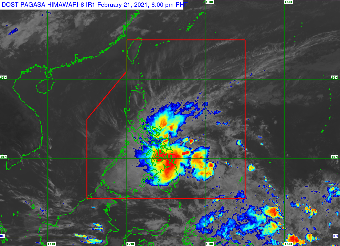
Auring maintains strength; Signal No. 2 still over parts of E. Visayas, Caraga
MANILA, Philippines — Tropical Storm Auring was able to maintain its strength as of Sunday afternoon as it starts to move northwest towards the tip of the Caraga Region, state meteorologists said.
According to updates from the Philippine Atmospheric, Geophysical and Astronomical Services Administration (Pagasa), Auring is still packing maximum sustained winds of 65 kilometers per hour (kph) and gusts of up to 80 kph.
Auring was last seen 285 kilometers east northeast of Hinatuan, Surigao del Sur, and has started to move northwest at a speed of 20 kph.
Auring is not expected to re-intensify as a severe tropical storm, but its thick cloud bands coupled with the resurgence of the northeast monsoon or amihan would cause rains over most parts of Visayas and Mindanao, as well as Central Luzon, Southern Luzon, and Bicol Region.
Pagasa said that Auring may now stray further north, this time moving towards Eastern Visayas, before proceeding to 75 kilometers south of Masbate by 2:00 p.m. of Monday, February 22.
Article continues after this advertisementBy Monday, Auring will turn into a tropical depression. It will further weaken as a low-pressure area by Tuesday afternoon, when it moves east, around 100 kilometers north northeast of Coron, Palawan.
Article continues after this advertisementPagasa said Tropical Cyclone Wind Signal No. 2 is still raised over the following areas:
central and southern portions of Eastern Samar
central and southern portions of Samar
eastern portion of Leyte
eastern portion of Southern Leyte
Dinagat Islands
Surigao del Norte including Siargao and Bucas Grande Island
Areas under Signal No. 2 may expect gusts from 61 kph to 120 kph and heavy to intense rains which may cause flash floods and landslides within the next 24 hours. Winds at this category, Pagasa said, can cause rough to very rough seas and uproot trees and destroy electrical and communication posts.
Meanwhile, the following areas are under Signal No. 1:
parts of Bicol Region (Sorsogon, Masbate including Ticao and Burias Island, Albay, Catanduanes, eastern portion of Camarines Sur)
eastern portion of Romblon
parts of Eastern Visayas (Northern Samar, rest of Eastern Samar, rest of Samar, Biliran, rest of Leyte, rest of Southern Leyte
parts of Central Visayas (Cebu, Bohol, Siquijor, Negros Oriental)
parts of Western Visayas (northern and central portions of Negros, Occidental, northern and central portions of Iloilo, Capiz, Guimaras, eastern portions of Aklan)
parts of Caraga Region (Surigao del Sur, Agusan del Sur)
parts of Davao region (Davao Oriental, Davao de Oro)
parts of Northern Mindanao (Camiguin, Misamis Oriental, Bukidnon)
Pagasa said there is a chance that Auring will move slightly north or south of its predicted track.
“Posibleng kumilos nang bahagya pa-hilaga or bahagya pa-Timog ng center track ang bagyong si Auring, kaya hindi lamang ho ang southern portion ng Eastern Samar, itong Leyte at itong northeastern portion ng Mindanao ang dapat maghanda sa landfall,” senior weather specialist Chris Perez said.
“Lahat po ng binaggit nating areas na may warning signal, nasa direct path ka man ng bagyo or within the periphery of the storm ay kailangang pong paghandaan ‘yong mga inaanticipate nating malalakas na pag-ulan at malalakas na hangin,” he added.
Pagasa predicts that from Sunday to Monday morning, moderate to heavy rain will be felt in Caraga, Eastern Visayas, Misamis Oriental, Bukidnon, Camiguin, Catanduanes, Albay, and Sorsogon.
Light to moderate rains and at times heavy rain will also be felt in the Zamboanga Peninsula, Mimaropa (Mindoro, Marinduque, Romblon, and Palawan), Davao Oriental, Davao de Oro, Quezon, and the rest of the Bicol Region, Visayas, and Mindanao.
Pagasa said a gale warning remains raised over the eastern and southern seaboards of Luzon and the western seaboards of Visayas, due to the combined effects of Auring and the amihan. Sea travel is not advised in areas under a gale warning and those with tropical wind signal warnings.
