More areas under Signal No. 1 as Auring maintains strength
MANILA, Philippines — More areas were placed under the Tropical Cyclone Wind Signal No. 1 warning as of Friday night, as Tropical Storm Auring maintained its strength.
The latest severe weather bulletin from the Philippine Atmospheric, Geophysical and Astronomical Services Administration (Pagasa) said that the following areas are now under Signal No. 1:
- Visayas
Northern Samar, Eastern Samar, Samar, Biliran, Leyte, Southern Leyte, Cebu, Negros Oriental, Bohol, and Siquijor - Mindanao
Dinagat Islands, Surigao del Norte, Surigao del Sur, Agusan del Norte, Agusan del Sur, Davao Oriental, Davao de Oro, Davao del Norte, Davao City, Camiguin, Misamis Oriental, Misamis Occidental, Lanao del Norte, Bukidnon, and Lanao del Sur
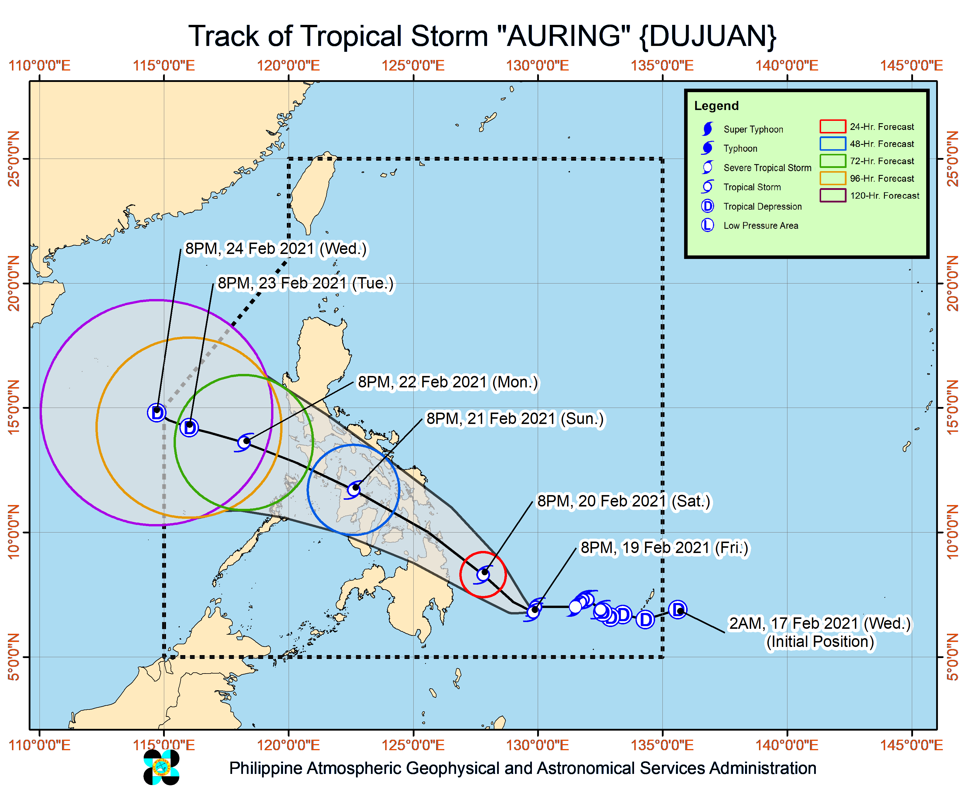
Pagasa said that Auring still packs maximum sustained winds of 85 kilometers per hour (kph) near the center, and gustiness of up to 105 kph. It was last seen 435 kilometers east southeast of Hinatuan of Surigao del Sur, moving very slowly over eastern Mindanao waters.
State meteorologists meanwhile said it is possible for Auring to remain as a tropical storm while crossing the country, possibly due to dry winds from the northeast monsoon or amihan. However, Pagasa does not rule out a scenario where it would re-intensify into a severe tropical storm.
As of now until Saturday morning, Caraga, Davao Oriental, Davao de Oro, Davao del Norte, Bukidnon, Misamis Oriental, and Southern Leyte would only experience light to moderate rains, which at times heavy rains.
But as Auring moves closer to the Caraga landmass between Saturday morning and Sunday morning, heavy to intense rains would be felt in Surigao del Norte and Dinagat Islands, while moderate to heavy with at times intense rains would persist over the rest of Caraga, Davao Oriental, Davao de Oro, Misamis Oriental, and Camiguin.
During the same time, Eastern Visayas, Central Visayas, the rest of Northern Mindanao, Lanao del Sur, Cotabato, and Davao City would be affected by light to moderate with at times heavy rains.
Auring is then expected to make landfall and graze the northern tip of Caraga by Sunday morning. After which, Auring would start to speed up, moving from Caraga to north of Cebu within hours, and hovering 20 kilometers northwest of Roxas City in Capiz.
From the Panay Island, it would move to waters between northern Palawan and eastern Mindoro, before exiting the landmass through the West Philippine Sea by Monday night.
From Sunday morning through Monday morning, Pagasa predicts that moderate to heavy rains with at times intense rains will be experienced in Visayas, Dinagat Islands, Surigao del Norte, the northern portion of Surigao del Sur, Agusan del Norte, Misamis Oriental, Camiguin, Catanduanes, Camarines Sur, Albay, Sorsogon, Masbate, and Romblon.
On the other hand, Zamboanga Peninsula, the southern portion of Quezon, Marinduque, Basilan, Lanao del Sur, Maguindanao, Cotabato City, Cotabato, Davao Oriental, Davao de Oro, Davao del Norte, Davao City, the rest of Bicol Region, Caraga, and Northern Mindanao, would see light to moderate with at times heavy rains.
Auring may leave the Philippine area of responsibility by Wednesday night, weakening as a tropical depression after it faces cold and dry winds from the amihan.
Pagasa warned that landslides and flash floods are possible in high risk spots, especially those in low-lying areas and those near mountain slopes.
As of now, gale warnings are still in place over the entire seaboards of Luzon, Visayas, and Northern Mindanao, because of Auring and the amihan. This means sailing is risky over these areas, while any form of sea travel is already suspended over coastlines of areas under Signal No. 1.
