Clouds, rains in Eastern parts of Mindanao as LPA approaches PH
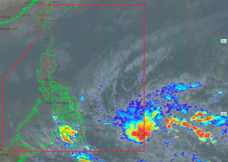
Satellite image from Himawari IR1 via Pagasa
MANILA, Philippines — The eastern parts of Mindanao may start seeing cloudy skies and experiencing rains on Wednesday as the low-pressure area (LPA) makes its way towards the Philippine area of responsibility (PAR), state meteorologists said.
Updates from the Philippine Atmospheric, Geophysical and Astronomical Services Administration (Pagasa) on Tuesday showed that the LPA was last spotted 1,530 kilometers east of Hinatuan, Surigao del Sur.
According to Pagasa senior weather specialist Chris Perez, weather advisories may be released starting Tuesday even if the LPA does not turn into a tropical cyclone yet.
“Wala pa itong direktang epekto sa anumang bahagi ng ating bansa pero dito sa eastern seaboard ng Mindanao ay posibleng maging maulap po ang weather, may mga pag-ulan at ilang pulo-pulong pagkidlat at pagkulog,” Perez said.
(The LPA still has no direct effect on any part of the country, but the eastern seaboards of Mindanao may cause cloudy weather, some rains and scattered thunderstorms, and lightning strikes.)
Article continues after this advertisement“Patuloy po tayong magmomonitor sa nabanggit na low pressure area at posibleng ngayong gabi hanggang bukas ng umaga ay magpalabas po tayo ng weather advisory hingil sa naturang sama ng panahon,” he added.
Article continues after this advertisement(We would continue to monitor this low-pressure area, and it is possible that we would release weather advisories between Tuesday night or Wednesday morning about this weather disturbance.)
In case it develops into a tropical depression upon entering PAR, it would be the first cyclone in the Philippines for 2021 and would be named “Auring.”
But for Luzon, the northeast monsoon and the tail end of a frontal system would still bring light rains and cold weather on Wednesday, especially on the eastern side of the island. Meanwhile, the remaining parts of Luzon may generally see fair weather.
Temperatures would be a bit warmer due to a weaker amihan, ranging from 21 to 30 degrees Celsius in Tuguegarao, 22 to 30 degrees in Laoag, 13 to 23 degrees in Baguio City, 23 to 30 degrees in Metro Manila, and 20 to 28 degrees in Tagaytay. Down south, it would be warm and humid over Puerto Princesa at 24 to 32 degrees.
The Visayas would also be affected by the frontal system, as temperatures in Tacloban play between 24 and 29 degrees Celsius and 25 and 30 degrees for Cebu and Iloilo. Mindanao would be warmer from 24 to 33 degrees; for Davao, 25 to 33 degrees in Zamboanga, and 23 to 31 degrees in Cagayan de Oro.
No gale warning has been raised as of now, but Pagasa warned fisherfolk sailing on the country’s northern and eastern waters to be extra careful, as sea conditions would range from moderate to strong. The rest of the country would have a slight to moderate sea condition.
ac