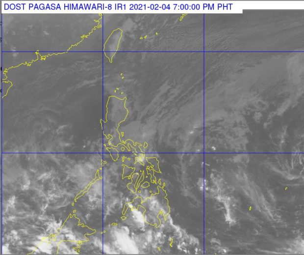
Source: Pagasa / DOST
MANILA, Philippines — The northeast monsoon slightly weakened but the tail end of a frontal system may still affect the country, bringing cloudy skies and rains over the eastern side according to state meteorologists.
Weather reports from the Philippine Atmospheric, Geophysical and Astronomical Services Administration (Pagasa) on Thursday afternoon showed that the northeast monsoon or amihan now only affects the northern and central parts of Luzon.
However, the frontal system or the shear line between the cold amihan and the warm easterlies brings cloud bands in the eastern parts of the country, especially in Bicol Region, Quezon province, Marinduque, Romblon, Mindoro provinces, and Eastern Visayas.
For the rest of Visayas and Mindanao, weather conditions would be fair except for isolated rain showers and thunderstorms.
Despite the supposed weakening of the amihan, temperatures over Luzon on Friday would still be low at 22 to 30 degrees Celsius in Metro Manila, 20 to 28 degrees in Tuguerao, 12 to 23 degrees in Baguio, 20 to 30 degrees in Laoag, 20 to 27 degrees in Tagaytay, and 23 to 29 degrees in Legazpi.
In Visayas, Tacloban would have slightly colder weather with 24 to 29 degrees Celsius, compared to Cebu’s 24 to 31 degrees and Iloilo’s 25 to 30 degrees. For Mindanao, Davao would have something around 25 to 31 degrees, Cagayan de Oro with 23 to 31 degrees, and Zamboanga with 24 to 33 degrees.
A gale warning remains raised over the eastern seaboards of Cagayan Valley, down to Aurora, Quezon province, Bicol Region, and northern waters of Eastern Visayas. The seaboards of Ilocos Norte are also under the gale warning, but it was lifted for the extreme northern Luzon area.