
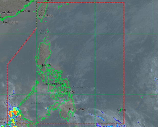
Amihan is expected to continue bringing colder weather over the weekend. Satellite image from Himawari IR1 via Pagasa
MANILA, Philippines — The northeast monsoon or Amihan is expected to continue bringing colder weather over the weekend, the Philippine Atmospheric, Geophysical and Astronomical Services Administration (Pagasa) said on Wednesday afternoon.
According to Pagasa’s weather updates, wind forecast models show that the prevailing wind pattern until Saturday would still be coming from the northeast, which signifies that the Amihan would continue to prevail.
The wind models also predict that no low-pressure area or tropical cyclone will develop near or inside the Philippine area of responsibility (PAR).
“Mapapansin natin throughout the outlook period ay manggagaling pa rin po sa hilagang silangan generally ‘yong amihan pa rin ang inaasahang makaka-apekto sa nakararaming bahagi ng ating bansa,” senior weather specialist Chris Perez said.
(We have observed that throughout the outlook period, winds would come from the northeast which generally means that the northeast monsoon is expected to affect a huge part of the country.)
“And so far, wala po tayong inaasahang bagyo na mabubuo sa loob ng PAR, or papasok ng PAR mula dito sa Karagatang Pasipiko, so generally bagyo-free po tayo for the next three days,” he added.
(And so far, we are not expecting any storm or weather disturbance to form or enter the PAR from the Pacific Ocean, so generally, the country is free from tropical cyclones for the next three days.)
From Wednesday to Thursday, cloudy skies and light rains would still be seen over the eastern part of the country, including parts of Northern Luzon, Cagayan Valley, Aurora and Quezon province, Southern Luzon, Bicol Region, and Eastern Visayas.
Pagasa warned that landslides and flash floods may occur in areas susceptible to these conditions, as the Amihan has brought rain showers in the past few days.
Meanwhile, the rest of Luzon and the country would have warmer and generally fair weather although rain showers are still possible by afternoon and night. Temperatures over northern and eastern parts Luzon would still be low, with 24 to 29 degrees Celsius over Legazpi, 19 to 27 degrees in Tuguegarao, and 12 to 23 degrees over Baguio.
Metro Manila temperatures would still be lower than usual at 22 to 31 degrees Celsius but not as low as the above-mentioned areas. Laoag would have 20 to 30 degrees, Tagaytay with 19 to 27 degrees, and Puerto Princesa at 25 to 31 degrees.
Visayas and Mindanao would also be warmer except for eastern portions. Tacloban may see temperatures of 24 to 29 degrees Celsius while Cagayan de Oro would have something between 23 to 31 degrees, lower compared to Iloilo and Cebu’s 25 to 30 degrees, Davao’s 24 to 31 degrees, and Zamboanga’s 24 to 33 degrees.
A gale warning over the northern and eastern seaboards of Luzon, from Ilocos Norte waters to Cagayan Valley, down to Quezon province and Bicol Region, are currently in place due to the amihan.
Fisherfolk are discouraged from setting sail as sea conditions may be rough to very rough, with waves reaching heights of 2.8 meters to 4.5 meters.
ac