Vicky accelerates, now over Agusan del Sur – Pagasa
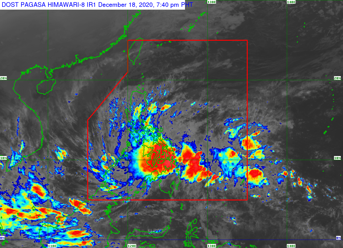
MANILA, Philippines — Tropical Depression Vicky has accelerated and is now over Esperanza, Agusan del Sur, the weather state bureau said Friday evening.
In its 8 p.m. severe weather bulletin, the Philippine Atmospheric, Geophysical and Astronomical Services Administration (Pagasa) said Vicky is forecast to move northwestward at 30 kph while over the landmass of Mindanao.
It has maximum sustained winds of 45 kph near the center and gustiness of up to 75 kph.
By Friday night or early Saturday morning, Vicky is likely to emerge over the Bohol Sea, pass close to Siquijor or Misamis Occidental, and pass close or make another landfall over the southern portion of Negros Island, according to Pagasa
The tropical depression is likely to emerge over the Sulu Sea Saturday morning or afternoon, it added.
Article continues after this advertisementVicky will remain a tropical depression while crossing the Philippine archipelago.
Tropical Cyclone Warning Signal (TCWS) 1 is hoisted up in the following areas:
- Luzon
- The northern and central portion of Palawan (Puerto Princesa City, Roxas, San Vicente, Dumaran, Araceli, Taytay, El Nido) including Calamian, Cuyo, and Cagayancillo Islands
- Visayas
- The southern portion of Leyte (Baybay City, Javier, Abuyog, Mahaplag, Inopacan, Hindang, Hilongos, Bato, Matalom, Palompon, Merida, Isabel)
- Southern Leyte, the central and southern portions of Cebu (Borbon, Tabuelan, Tuburan, Sogod, Catmon, Carmen, Asturias, Danao City, Compostela, Liloan, Consolacion, Mandaue City, Lapu-Lapu City, Cordoba, Balamban, Cebu City, Talisay City, Toledo City, Minglanilla, Naga City, Pinamungahan, San Fernando, Aloguinsan, Carcar, Barili, Sibonga, Dumanjug, Ronda, Alcantara, Moalboal, Argao, Dalaguete, Badian, Alegria, Alcoy, Boljoon, Oslob, Malabuyoc, Ginatilan, Samboan, Santander) including Camotes Islands
- Bohol
- Siquijor
- Negros Oriental
- Negros Occidental,
- Guimaras
- central and southern portions of Iloilo (Ajuy, Barotac Viejo, San Enrique, San Rafael, Passi City, Bingawan, Calinog, Lambunao, Janiuay, Banate, Anilao, Dingle, Duenas, Badiangan, Barotac Nuevo, Zarraga, Pototan, Dumangas, Mina, New Lucena, Santa Barbara, Leganes, Iloilo City, Pavia, Cabatuan, Maasin, Alimodian, San Miguel, Leon, Oton, Tigbauan, Tubungan, Guimbal, Igbaras, Miagao, San Joaquin)
- southern portion of Antique (Valderrama, San Remigio, Sibalom, Hamtic, Tobias Fornier, Anini-Y, Bugasong, Laua-An, Patnongon, San Jose, Belison)
- Mindanao
- Dinagat Islands
- Surigao del Norte
- Surigao del Sur
- Agusan del Norte
- Agusan del Sur
- Davao Oriental
- Davao del Norte
- Davao de Oro
- Davao City
- northern portion of Davao del Sur (Santa Cruz, Digos City, Bansalan, Magsaysay, Matanao, Hagonoy)
- Camiguin
- Bukidnon
- Misamis Oriental
- Misamis Occidental
- Lanao del Norte
- Lanao del Sur
- Maguindanao
- Cotabato City
- North Cotabato
- Zamboanga del Sur
- Zamboanga Sibugay
- northern portion of Zamboanga del Norte (Baliguian, Gutalac, Kalawit, Labason, Tampilisan, Liloy, Salug, Bacungan, Godod, Sindangan, Siayan, Jose Dalman, Manukan, Sergio Osmena Sr., Pres. Manuel A. Roxas, Katipunan, Dipolog City, Polanco, Pinan, Mutia, La Libertad, Dapitan City, Sibutad, Rizal)
Pagasa said areas under TCWS#1 would have a strong breeze to near gale conditions during the tropical cyclone passage. [ac]