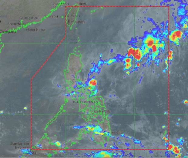
MANILA, Philippines — The low-pressure area (LPA) spotted off Eastern Samar is expected to disappear on Wednesday but will dampen Visayas areas, the state weather bureau said Tuesday.
“Muli po, mabababa ang chance ng LPA nito na maging bagyo. Inaasahan ang pagtama sa kalupaan ng Eastern Visayas o Bicol Region. Ito ay posibleng malusaw pero ito ay magiiwan ng kaulapan sa ibang bahagi ng bansa bukas,” Ariel Rojas, weather specialist of Philippine Atmospheric, Geophysical and Astronomical Services Administration (Pagasa), said in a 5 p.m. live weather forecast on Pagasa’s Facebook page.
(Again, there is a slim chance that this LPA will become a typhoon. We are expecting it will make landfall in Eastern Visayas or Bicol Region. It is possible that it would dissipate but will leave clouds in some areas in the country.)
The LPA was last spotted 115 kilometers east of Borongan City, Eastern Samar, said Rojas.
On Wednesday, Rojas said the LPA would bring rains over the whole of the Visayas region.
Meanwhile, Rojas added that the frontal system’s tail-end would bring rains over Cagayan Valley, Aurora, Quezon and Bicol Region on Wednesday.
Rojas reminded residents that they might encounter flash floods and landslides due to the bad weather.
The Mimaropa region will also experience fair weather and light rains due to the tail-end of the frontal system, Rojas also noted. [ac]
