Signal No. 2 lifted in all areas in PH as Ulysses slightly weakens

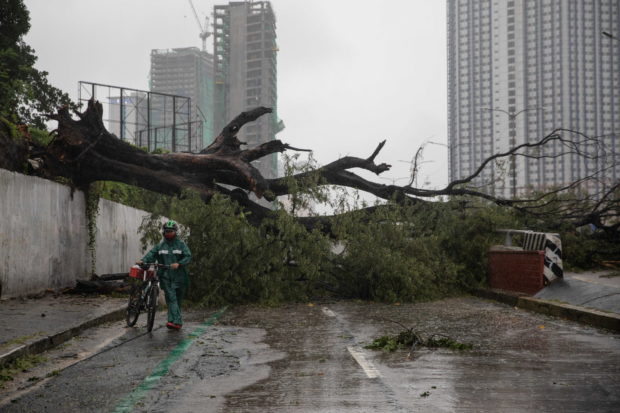
A man walks his bike past a fallen tree following Typhoon Ulysses (international name: Vamco), at a road in Quezon City, Metro Manila, Philippines, on November 12, 2020. REUTERS/Eloisa Lopez
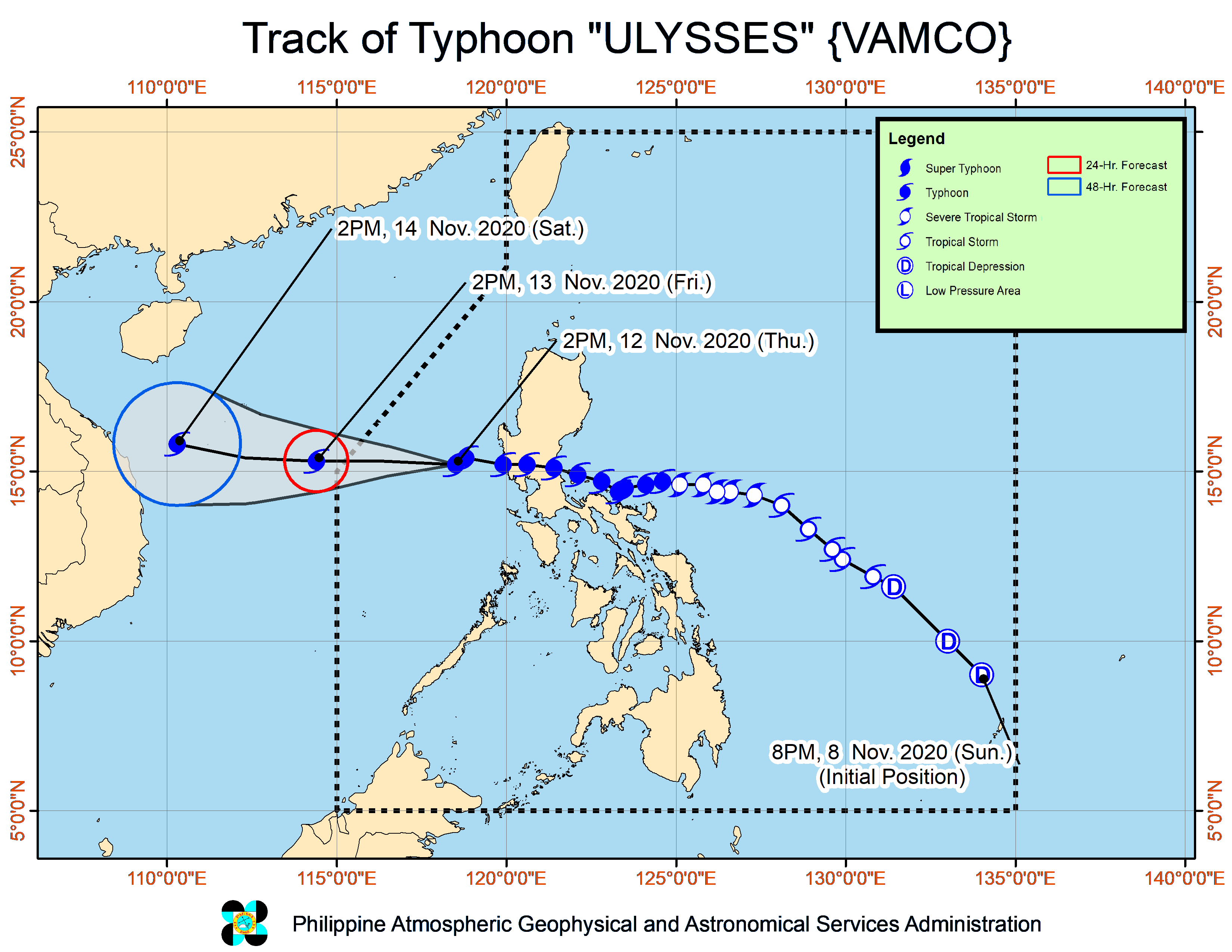
MANILA, Philippines — Tropical Cyclone Wind Signal No. 2 has been lifted in all areas in the country as Typhoon Ulysses (international name: Vamco) slightly weakened on Thursday afternoon while moving over the West Philippine Sea.
In its 5 p.m. weather bulletin, the Philippine Atmospheric, Geophysical and Astronomical Services Administration (Pagasa) said Ulysses was last seen 200 kilometers west of Iba, Zambales packing maximum sustained winds of 120 kilometers per hour (kph) near the center and gustiness of up to 150 kph.
Pagasa also said Ulysses was moving westward at 25 kph and is likely to exit the Philippine Area of Responsibility on Friday morning.
However, Tropical Cyclone Wind Signal No. 1 is still hoisted over the following:
- Western portion of Pangasinan (Bautista, Alcala, Malasiqui, Santo Tomas, Santa Barbara, Mapandan, Mangaldan, Dagupan City, Calasiao, San Carlos City, Basista, Bayambang, Urbiztondo, Mangatarem, Aguilar, Binmaley, Lingayen, Bugallon, Labrador, Infanta, Mabini, Dasol, Sual, Alaminos City, Burgos, Agno, Bani, Bolinao, Anda)
- Tarlac
- Western portion of Pampanga (Magalang, Mabalacat, Angeles City, Porac, Floridablanca, Arayat, Mexico, Santa Ana, San Fernando City, Bacolor, Santa Rita, Guagua, Lubao, Sasmuan)
- Zambales
- Bataan
- Lubang Island
The state weather bureau said strong breeze to near gale conditions may prevail in areas under Signal No. 1 while the surge of the northeast monsoon will bring strong breeze to gale-force winds over Northern Luzon.
Pagasa added that moderate to heavy rains may be expected over the Cordillera Administrative Region, the eastern portions of Cagayan and Isabela, Zambales, Bataan, Aurora, Cavite, western portion of Batangas, and Occidental Mindoro, including Lubang Island.
Meanwhile, light to moderate with at times heavy rains may be experienced in Western Visayas, Samar Provinces, Metro Manila, and the rest of Luzon.
“Flooding (including flashfloods), rain-induced landslides, and sediment-laden streamflows (i.e. lahar) may occur during heavy or prolonged rainfall especially in areas that are highly or very highly susceptible to these hazards and/or those that received significant antecedent rainfall,” Pagasa said.
KGA


