Tonyo moves out, new LPA east of PH may turn into tropical depression– Pagasa
MANILA, Philippines — As Tropical Depression Tonyo moves away from the country’s landmass, state meteorologists are monitoring a new low-pressure area (LPA) which may develop into a tropical depression.
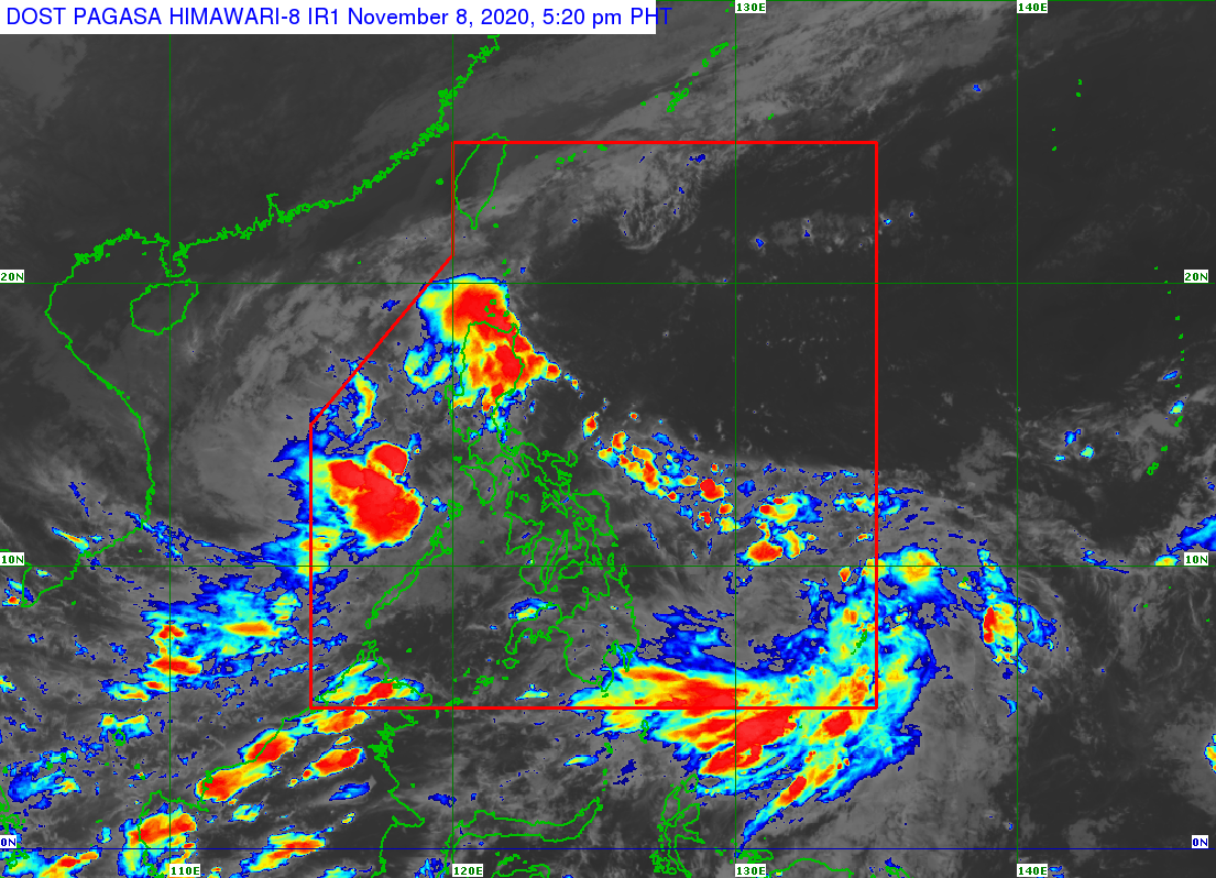
Weather forecasts from the Philippine Atmospheric, Geophysical and Astronomical Services Administration (Pagasa) on Sunday showed Tonyo moving southwest, to the western border of the Philippine area of responsibility (PAR).
Despite this movement, cloudy and rainy skies will prevail from Sunday afternoon to early Monday morning as Tonyo’s trough may still affect areas in Southern Luzon.
Tonyo was last located 185 kilometers west of Calapan City in Mindoro, with maximum sustained winds of 45 kilometers per hour (kph) and gusts of up to 55 kph.
As it is expected to exit PAR between Sunday evening to Monday afternoon, no tropical cyclone wind signals are currently raised in any part of the country.
Article continues after this advertisementMeanwhile, Pagasa said it is not discounting the possibility that the LPA located 900 kilometers east of Mindanao may develop into a tropical depression.
Article continues after this advertisement“Nagpalabas na po tayo ng weather advisory hinggil sa naturang sama ng panahon, dahil within the next 24 to 36 hours ay hindi natin isinasantabi ang posibilidad na pwede itong maging isang ganap na bagyo,” senior weather specialist Chris Perez said.
(We already released weather advisories due to the low pressure area, because within the next 24 to 48 hours we are not setting aside the possibility that becomes another tropical depression.)
“Sa susunod na dalawa hanggang tatlong araw ay kikilos patungo dito sa Central and Southern Luzon area,” he added.
(For the next two to three days this would move towards the Central and Southern Luzon area.)
For the meantime, the weather over a huge part of Luzon will slightly improve as Tonyo moves away.
Except for Northern Luzon which will be affected by easterlies, it may be warm and humid over Metro Manila and Palawan which will both register temperatures of 24 to 32 degrees Celsius, as Legazpi and Laoag can both expect something between 24 to 31 degrees.
Hot weather would also persist over Visayas and Mindanao although there is still a chance of rain, especially in the afternoon. Iloilo, Cebu, and Tacloban will see temperatures ranging from 25 to 32 degrees, while it would be 24 to 33 degrees in Davao and Zamboanga.
Gale warnings are still in place over the seaboards of Batanes, Ilocos Norte, Ilocos Sur, and the northern coastlines of Cagayan as seas may be rough to very rough. This means small boats are not allowed to set sail in these areas.