Siony now a Severe Tropical Storm, may move over Northern Luzon on Thursday
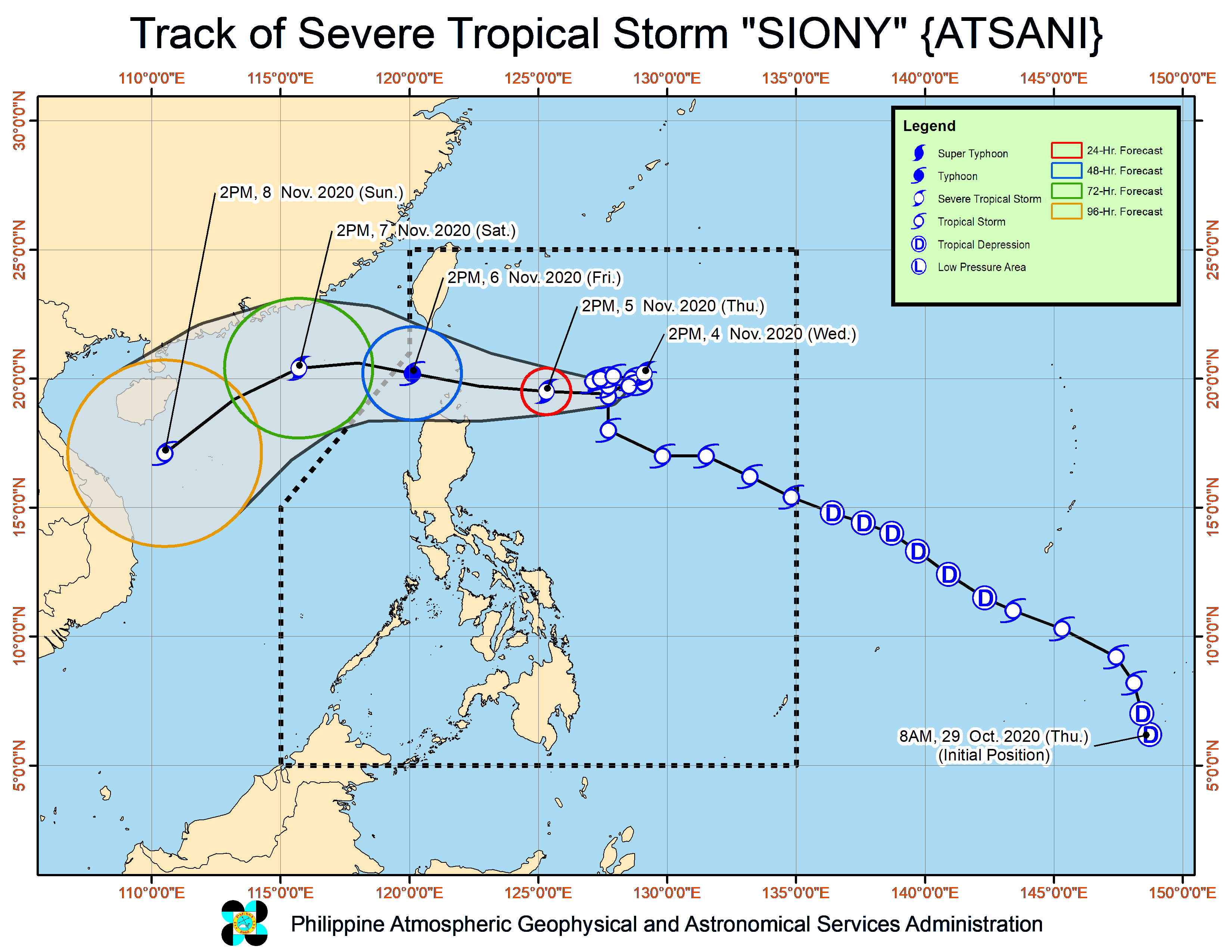
MANILA, Philippines — Severe Tropical Storm Siony has intensified further as it remains almost stationary over the Philippine Sea, with state meteorologists saying that it may intensify further as a typhoon category before making landfall.
The Philippine Atmospheric, Geophysical and Astronomical Services Administration (Pagasa) severe weather bulletin as of Wednesday afternoon said that Siony now packs maximum sustained winds of 95 kilometers per hour (kph) and gustiness of up to 115 kph.
It was last seen 735 kilometers east of Basco, Batanes. After completing its almost stationary loop, Siony is expected to move westward and near the extreme Northern Luzon areas of Batanes and Babuyan Islands between Thursday evening and Friday morning.
Although latest forecast track from Pagasa shows that Siony may move above the northern islands, Pagasa is still not ruling out a landfall scenario.
Siony’s cone of probability remains wide, meaning that movement predictions may vary from as far as southern Taiwan and the northern portions of Ilocos Norte and Cagayan.
As of now, Tropical Cyclone Wind Signal No. 1 is raised over the following areas, which may experience wind speeds of 30 kph to 60 kph:
- Northeastern portion of mainland Cagayan (Santa Ana, Gonzaga)
- Eastern portion of Babuyan Islands (Balintang Island, Babuyan Island., Didicas Island, and Camiguin Island, including the adjoining islets)
Strong winds may start to affect Cagayan Valley and Ilocos Norte as Siony and Tropical Storm Goni, formerly known as Rolly, intensifies the northeasterly surface windflow.
Light to moderate with at times heavy rains may also be felt over Bicol Region which recently endured Super Typhoon Rolly’s impact, plus the areas of Aurora, Quezon, and the eastern portions of Cagayan and Isabela.
Pagasa warned that flooding may still occur in areas that would experience continuous rains, as well as rain-induced landslides during heavy or prolonged rainfall.
The state weather bureau reminded people living near mountain slopes that erosion is probable in areas that received significant rainfall from tropical cyclones Pepito, Quinta, and Rolly.
Gale warnings are also in place as the enhanced northeasterly surface windflow is expected to bring rough to rough seas over the entire seaboard of Northern Luzon, the northern seaboard of Camarines Sur, the northern and eastern seaboards of Catanduanes, and the seaboards of Aurora, Camarines Norte, Kalayaan Islands, and northern Quezon.
This means small boats are currently not allowed to travel along these areas.