Source: Pagasa / DOST
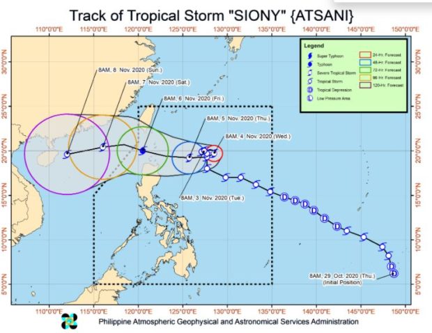
MANILA, Philippines — Tropical storm Siony (international name: Atsani) slightly intensified as it moved slowly over the Philippine sea east of extreme northern Luzon and is likely to intensify into a typhoon on Thursday.
In its 11 a.m. severe weather bulletin, the Philippine Atmospheric, Geophysical and Astronomical Services Administration (Pagasa) on Tuesday said that Siony was also forecast to intensify to a severe tropical storm in the next 24 to 36 hours.
State meteorologists also said that intensification of Siony to a typhoon is likely on Thursday prior to close approach or landfall over Extreme Northern Luzon.
Based on Pagasa’s latest data, Siony was last spotted at 565 kilometers east of Basco, Batanes.
Siony also packed maximum sustained winds of 85 kilometers per hour (kph) near the center, and gustiness of up to 105 kph.
The tropical storm was spotted moving east-northeastward slowly.
Pagasa previously said that it was closely monitoring Siony’s track as local predictions have a high degree of uncertainty, adding that it expects Siony’s behavior to be “erratic” and make a loop while hovering over the sea in the next two days due to two high-pressure systems pushing it.
Siony’s trough, along with the effects of the northeasterlies, will bring light to moderate with at times heavy rains over Batanes, Apayao, Cagayan, and Isabela on Tuesday, Pagasa said.