2 more Luzon areas under Signal No. 3 as Rolly moves towards Bicol
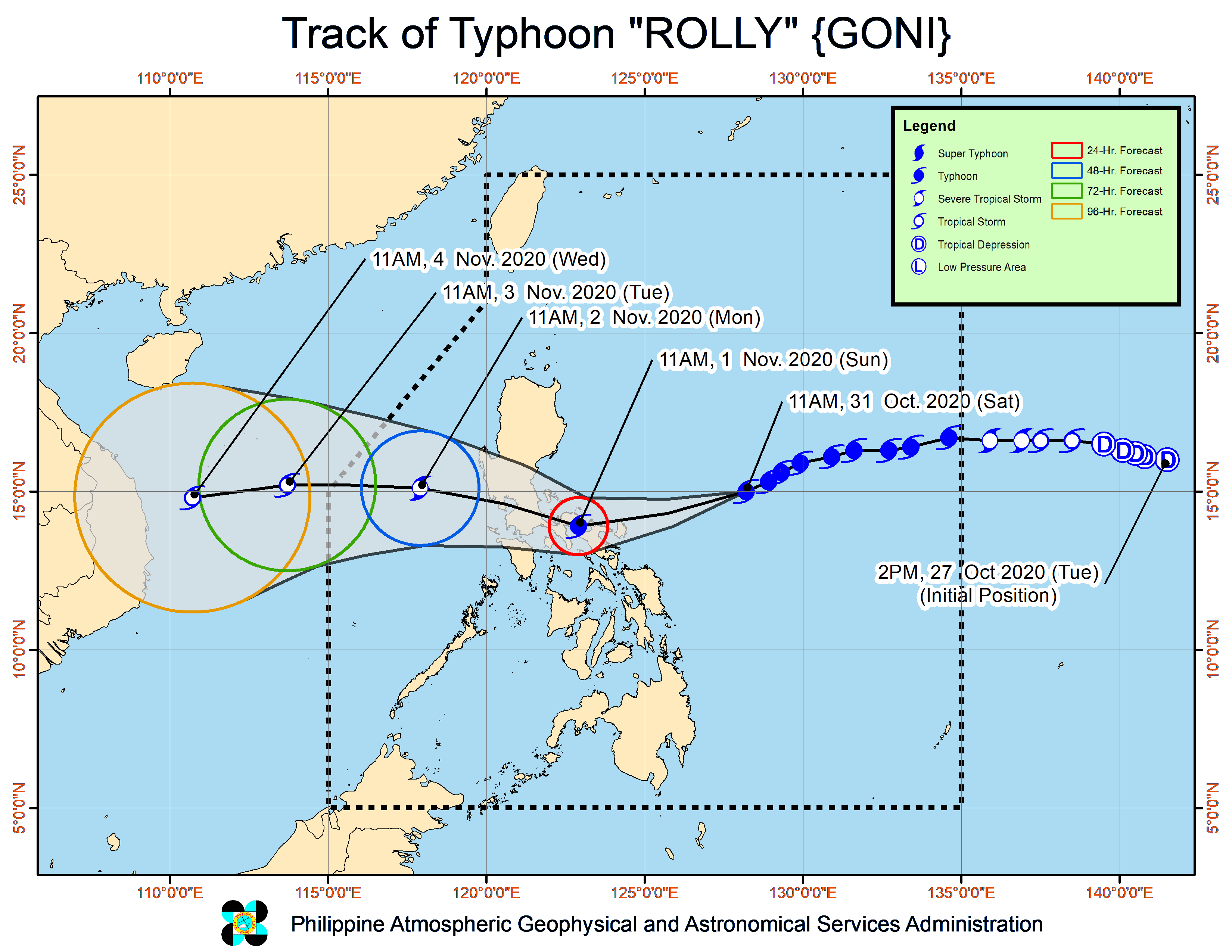
MANILA, Philippines — Two more areas were placed under Tropical Cyclone Wind Signal (TCWS) No. 3 as Typhoon Rolly (international name: Goni) continues to move west-southwestward towards the Bicol region, the state weather bureau said Saturday.
In its 2 p.m. severe weather bulletin, the Philippine Atmospheric, Geophysical and Astronomical Services Administration (Pagasa) said that aside from Catanduanes, TCWS No. 3 is now hoisted over the northeastern portion of Camarines Sur (Tinambac, Siruma, Goa, Tigaon, Sagnay, San Jose, Lagonoy, Garchitorena, Presentacion, Caramoan, Sagnay) and the northeastern portion of Albay (Tiwi, Malinao, Tabaco City, Malilipot, Santo Domingo, Bacacay, Rapu-Rapu).
Under TCWS No. 3, winds of greater than 121 kilometers per hour (kph) to 170 kph may be expected for at least 18 hours.
Meanwhile, TCWS No. 2, where winds of greater than 61 kph and up to 120 kph may be expected for at least 24 hours, is raised over:
The southeastern portion of Laguna (Santa Maria, Famy, Mabitac, Pakil, Siniloan, Pangil, Paete, Kalayaan, Lumban, Cavinti, Pagsanjan, Luisiana, Majayjay, Magdalena, Santa Cruz, Pila, Liliw, Nagcarlan, Rizal, Victoria, Calauan, San Pablo City, Alaminos, Bay),
Quezon including Polillo Islands
Camarines Norte
the rest of Camarines Sur
the rest of Albay
Sorsogon
the northern portion of Masbate (Mobo, Milagros, Masbate City, Baleno, Aroroy, Mandaon, Balud) including Ticao and Burias Islands
Marinduque
Romblon
TCWS No. 1, having winds of 30 to 60 kph may be expected in at least 36 hours or intermittent rains may be expected within 36 hours, is hoisted over:
Rizal
the rest of Laguna
Cavite
Batangas
Occidental Mindoro including Lubang Island
Oriental Mindoro
Metro Manila
Bulacan
Pampanga
Bataan
Zambales
Tarlac
Nueva Ecija
Aurora
Pangasinan
La Union
Benguet
Ifugao
Nueva Vizcaya
Quirino
the southern portion of Isabela (Aurora, Luna, Reina Mercedes, Naguilian, Benito Soliven, San Mariano, Palanan, Dinapigue, San Guillermo, Echague, San Agustin, Jones, Cordon, Santiago City, Ramon, San Isidro, Angadanan, Alicia, Cauayan City, Cabatuan, San Mateo)
Based on Pagasa’s latest data, Rolly was spotted at 410 kilometers east northeast of Virac, Catanduanes.
Rolly is packing maximum sustained winds of 215 kph near the center and gustiness of up to 265 kph.
The typhoon was also monitored moving west-southwestward at 15 kph
State meteorologists said that based on its forecast track, the center of the eye of the typhoon is forecast to pass over Catanduanes – mainland Camarines provinces area Sunday morning, and over mainland Quezon Sunday afternoon.
“Violent winds and intense rainfall associated with the inner rainband-eyewall region will be experienced over Catanduanes, Camarines provinces tomorrow early morning through the afternoon and over Quezon and the southern portion of Aurora tomorrow afternoon through evening,” Pagasa said.
“After crossing the Southern Luzon – Metro Manila area, the center of Rolly is forecast to exit the mainland Luzon landmass on Monday morning,” it added.
Rolly is also expected to remain as a typhoon by the time it makes landfall.
Pagasa said that for Saturday, the outer rainbands of Rolly will bring light to moderate with at times heavy rains over Bicol Region and Eastern Visayas.
Beginning Sunday early morning, the passage of Rolly will bring heavy to intense rain over Metro Manila, the Bicol Region, Cavite, Laguna, Batangas, Rizal, Quezon province, Central Luzon, Marinduque, and the northern portions Occidental Mindoro and Oriental Mindoro.
Moderate to heavy rains will be experienced over Cagayan Valley, Cordillera Administrative Region, Ilocos Region, Romblon, and the rest of Occidental Mindoro and Oriental Mindoro, Pagasa added.
Aside from Rolly, Pagasa is also monitoring a tropical depression, named Atsani, outside of the Philippine Area of Responsibility.
Atsani was spotted 1,655 kilometers east of Southern Luzon, and currently has maximum sustained winds of 55 kph near the center and gustiness of up to 70 kph.
It was also moving northwestward at 25 kph.
The tropical depression is expected to enter the Philippine landmass by Sunday afternoon.
Entering the Philippine landmass, Atsani will be given the local name Siony.
/MUF