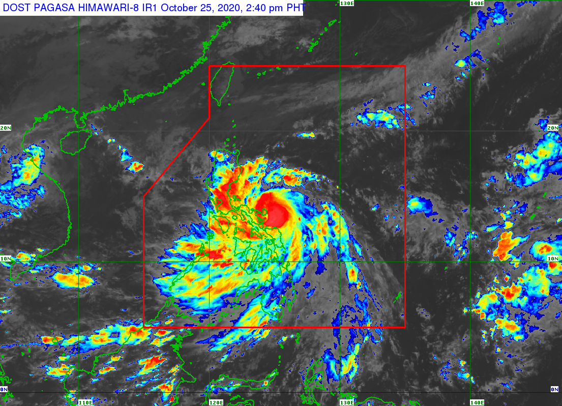
Moderate to heavy rains over parts of Luzon as Quinta intensifies
MANILA, Philippines — Moderate to heavy rains are expected over parts of Luzon as Severe Tropical Storm Quinta (international name: Molave) continues to intensify and increase its threat over the Catanduanes-Albay area, the state weather bureau said Sunday.
In its 2 p.m. weather bulletin, the Philippine Atmospheric, Geophysical and Astronomical Services Administration (Pagasa) said moderate to heavy with at times intense rains are expected over the Bicol Region, Cavite, Laguna, Batangas, Rizal, Quezon province, Aurora, Occidental Mindoro, Oriental Mindoro, Romblon, Marinduque, Calamian Islands, Northern Samar, Eastern Samar, Samar, Biliran, Aklan, and Antique due to Quinta.
Meanwhile, the tail-end of a frontal system will likewise bring moderate to heavy with at times intense rains over Cagayan, Isabela, Apayao, and Ilocos Norte.
And the two weather systems will also bring light to moderate with at times heavy rain over Metro Manila and the rest of Luzon, Zamboanga Peninsula, Bangsamoro, Northern Mindanao, Caraga, and the rest of the Visayas.
Based on Pagasa’s latest data, Quinta was last spotted at 95 kilometers east of Virac, Catanduanes.
Article continues after this advertisementQuinta is packing maximum sustained winds of 110 kilometers per hour (kph) near the center and gustiness of up to 135 kph.
Article continues after this advertisementThe severe tropical storm was also monitored moving westward at 25 kph.
Quinta is expected to make landfall over the Catanduanes-Albay area between Sunday afternoon or Sunday evening.
Tropical Cyclone Wind Signal (TCWS) No. 2 is hoisted over the following areas:
Catanduanes
Camarines Norte
Camarines Sur
Albay
Sorsogon
Masbate including Burias and Ticao Islands
the central and southern portions of Quezon (Mauban, Sampaloc, Lucban, Dolores, Candelaria, Tiaong, San Antonio, Sariaya, Tayabas City, Lucena City, Pagbilao, Atimonan, Perez, Alabat, Calauag, Quezon, Tagkawayan, Guinayangan, Lopez, Pitogo, Plaridel, Gumaca, Unisan, Agdangan, Padre Burgos, Macalelon, Catanauan, General Luna, Buenavista, San Narciso, Mulanay, San Andres, San Francisco)
the southeastern portion of Laguna (Paete, Kalayaan, Lumban, Cavinti, Luisiana, Majayjay, Liliw, Rizal, Nagcarlan, San Pablo City, Alaminos, Magdalena, Pagsanjan)
Batangas
Marinduque
Romblon
Oriental Mindoro
Occidental Mindoro including Lubang Island
Northern Samar
TCWS No. 1, meanwhile, is raised over:
The rest of Quezon
the rest of Laguna
Rizal
Cavite
Metro Manila
Bulacan
Pampanga
Bataan
the southern portion of Zambales (San Marcelino, San Felipe, San Narciso, Castillejos, Subic, San Antonio, Olongapo City, Botolan, Cabangan)
Calamian Islands
The northern portion of Samar (Calbayog City, Matuguinao, Tagapul-An, Santo Nino, Almagro, Santa Margarita, Gandara, San Jose de Buan, Pagsanghan, Tarangnan, San Jorge, Catbalogan City, Jiabong, Motiong, Paranas)
the northern portion of Eastern Samar (Maslog, Jipapad, Arteche, San Policarpo, Oras, Dolores, Can-Avid, Taft)
the northern portion of Capiz (Sapi-An, Ivisan, Roxas City, Panay, Pilar, Pontevedra, President Roxas), Aklan, the northern portion of Antique (Caluya, Libertad, Pandan, Sebaste, Culasi)
the northeastern portion of Iloilo (Batad, Balasan, Estancia, Carles)
Quinta is expected to exit the Philippine Area of Responsibility on Tuesday morning.
