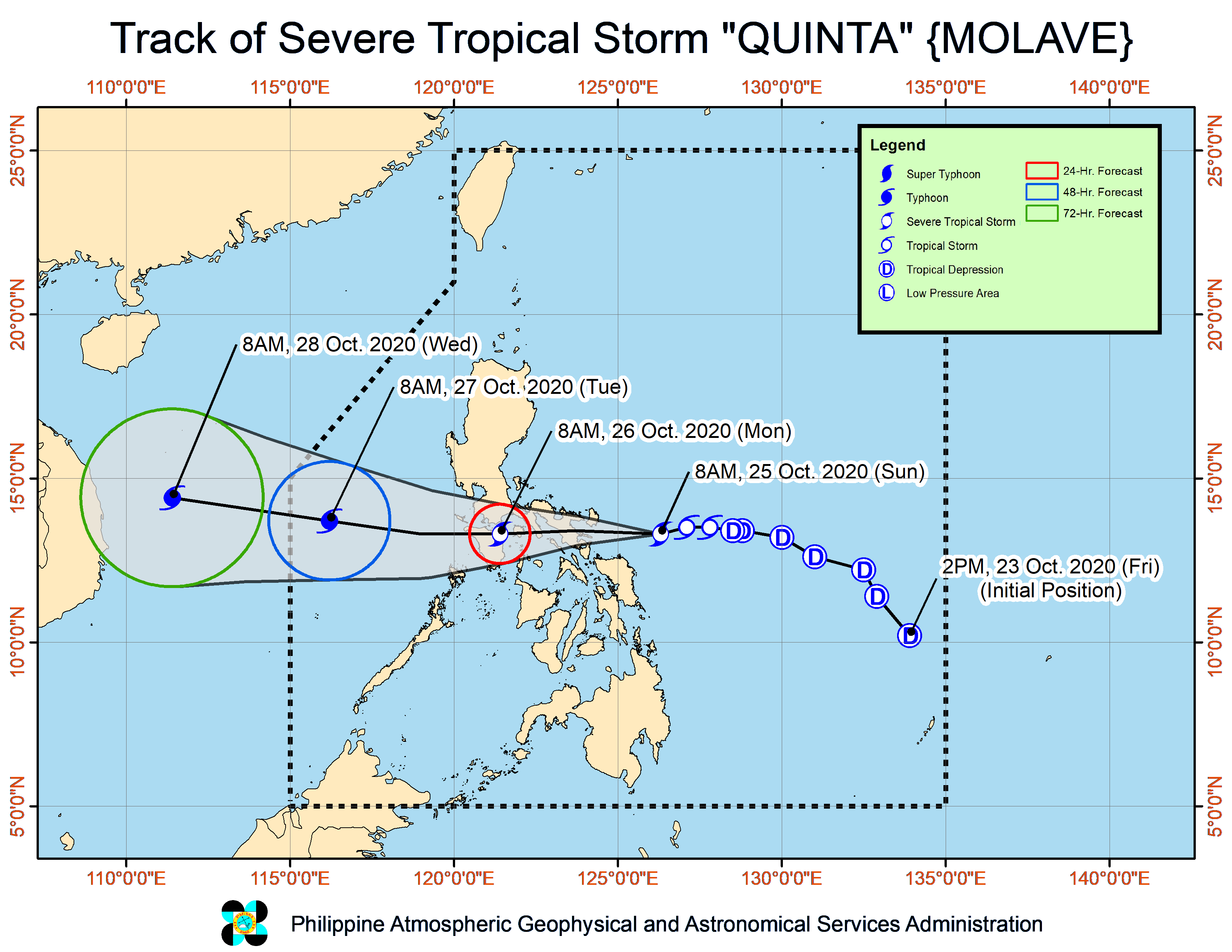

MANILA, Philippines — Tropical storm “Quinta” (international name: Molave) intensified into a severe tropical storm hours before it is set to drench the Catanduanes-Albay-Sorsogon area, the state weather bureau said Sunday.
In its 11 a.m. weather bulletin, the Philippine Atmospheric, Geophysical and Astronomical Services Administration (Pagasa) said that Quinta was spotted at 180 kilometers east of Virac, Catanduanes.
Quinta packed maximum sustained winds of 95 kilometers per hour (kph) near the center and gustiness of up to 115 kph.
The severe tropical storm was also spotted moving westward at 25 kph.
Based on Pagasa’s monitoring, Quinta is expected to make landfall over the Catanduanes-Albay-Sorsogon area by Sunday afternoon or evening.
Tropical Cyclone Wind Signal (TCWS) No. 2 is hoisted over the following areas:
- Catanduanes
- Camarines Norte
- Camarines Sur
- Albay
- Sorsogon
- Masbate including Burias and Ticao Islands
- The central and southern portions of Quezon (Mauban, Sampaloc, Lucban, Dolores, Candelaria, Tiaong, San Antonio, Sariaya, Tayabas City, Lucena City, Pagbilao, Atimonan, Perez, Alabat, Calauag, Quezon, Tagkawayan, Guinayangan, Lopez, Pitogo, Plaridel, Gumaca, Unisan, Agdangan, Padre Burgos, Macalelon, Catanauan, General Luna, Buenavista, San Narciso, Mulanay, San Andres, San Francisco)
- Batangas
- Marinduque
- Romblon
- Oriental Mindoro
- Occidental Mindoro including Lubang Island
- Northern Samar
Meanwhile, TCWS No. 1 is raised over:
- The rest of Quezon
- Laguna
- Rizal
- Cavite
- Metro Manila
- Bulacan
- Pampanga
- Bataan
- The southern portion of Zambales (San Marcelino, San Felipe, San Narciso, Castillejos, Subic, San Antonio, Olongapo City, Botolan, Cabangan)
- Calamian Islands
- The northern portion of Samar (Calbayog City, Matuguinao, Tagapul-An, Santo Nino, Almagro, Santa Margarita, Gandara, San Jose de Buan, Pagsanghan, Tarangnan, San Jorge, Catbalogan City, Jiabong, Motiong, Paranas)
- The northern portion of Eastern Samar (Maslog, Jipapad, Arteche, San Policarpo, Oras, Dolores, Can-Avid, Taft)
- The northern portion of Capiz (Sapi-An, Ivisan, Roxas City, Panay, Pilar, Pontevedra, President Roxas), Aklan, the northern portion of Antique (Caluya, Libertad, Pandan, Sebaste, Culasi)
- The northeastern portion of Iloilo (Batad, Balasan, Estancia, Carles)
Because of Quinta, moderate to heavy with at times intense rains will pour over Bicol Region, Cavite, Laguna, Batangas, Rizal, Quezon province, Aurora, Occidental Mindoro, Oriental Mindoro, Romblon, Marinduque, Calamian Islands, Northern Samar, Eastern Samar, Samar, Biliran, Aklan, and Antique.
Meanwhile, the tail-end of a frontal system will likewise bring moderate to heavy with at times intense rains over the northern portions of mainland Cagayan including Babuyan Islands, Apayao, and Ilocos Norte.
These two weather systems will also bring light to moderate with at times heavy rains over Metro Manila, Cordillera Administrative Region, Zamboanga Peninsula, Bangsamoro, Northern Mindanao, Caraga, and the rest of Visayas, Cagayan Valley, Central Luzon, and Mimaropa (Mindoro, Marinduque, Romblon, Palawan), Pagasa said.
Quinta is expected to exit the Philippine Area of Responsibility on Tuesday afternoon.