
Image curtesy of bagong.pagasa.dost.gov.ph
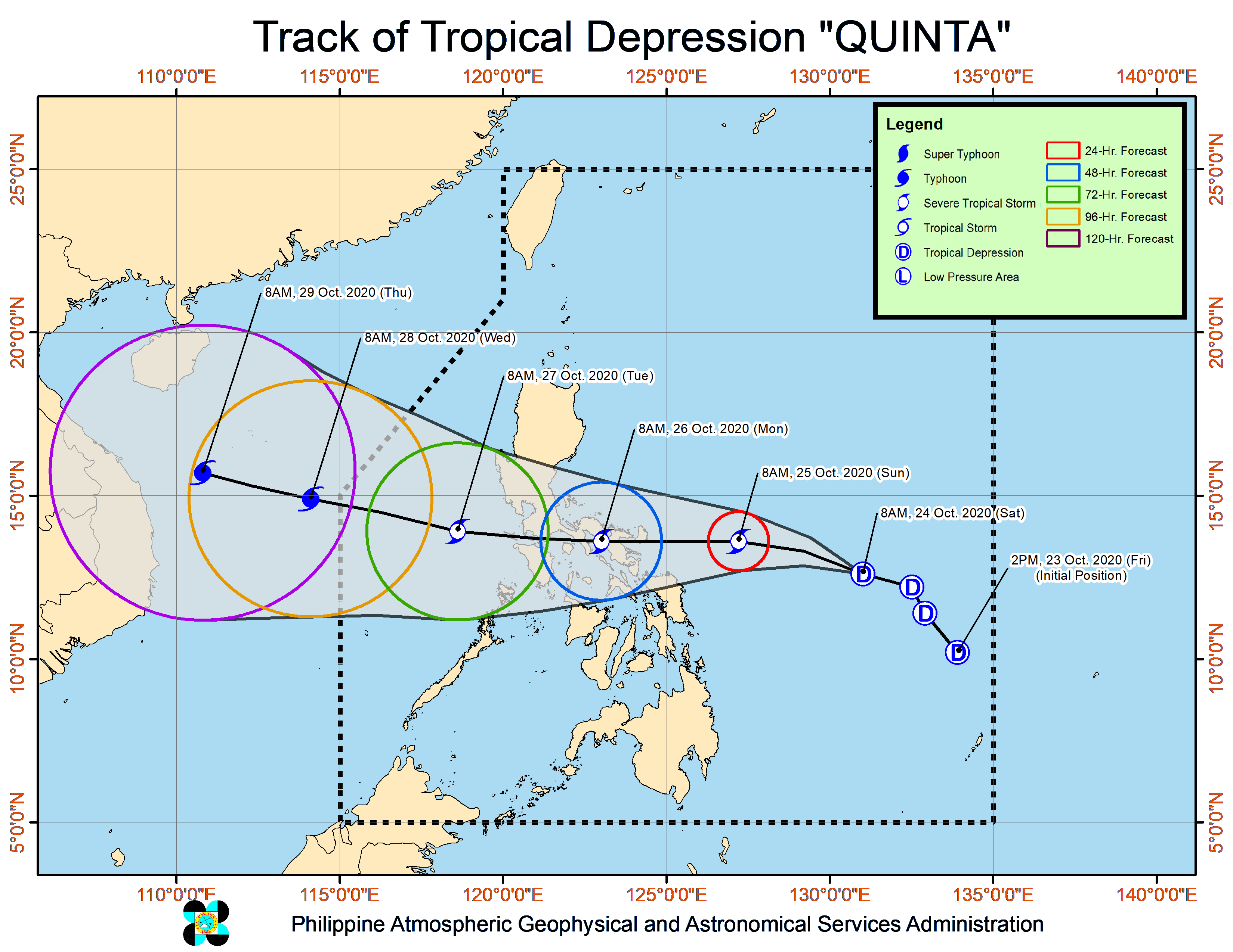
In its 11 a.m. weather update, the Philippine Atmospheric, Geophysical and Astronomical Services Administration (Pagasa) said that “Quinta” was last spotted at 660 kilometers east of Catarman, Northern Samar or 730 kilometers east of Juban, Sorsogon.
“Quinta” is also forecast to steadily intensify into a tropical storm within 12 hours, and may reach severe tropical storm category prior to landfall.
“Quinta” packs maximum sustained winds of 55 kilometers per hour (kph) near the center and gustiness of up to 70 kph and is moving west northwest at 30 kph.
Based on Pagasa’s monitoring, “Quinta” is expected to make landfall in the Bicol region between Sunday evening and Monday morning.
The tropical depression as well as the trough of Typhoon Saudel (formerly known as Pepito) outside of the Philippine Area of Responsibility (PAR) will bring bring light to moderate with at times heavy rains over Mimaropa (Mindoro, Marinduque, Romblon, Palawan), Bicol region, Visayas, Zamboanga Peninsula, Bangsamoro region, Northern Mindanao and Caraga on Saturday.